Education and Training
Events and Training
GRS works with a variety of geospatial professionals to create educational events for both ASU students as well as professionals outside of academia.
Career Navigator
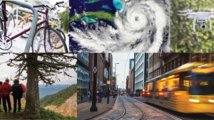
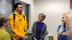
GRS developed and helps to oversee the annual Career Navigator event, which brings professionals to ASU to talk to students about career opportunities. This event has been taking place at ASU since 2006. Due to limited travel in 2020, SGSUP and GRS teamed up with several industry leaders to share how they use geography, GIS and urban planning in their careers for a series of videos. From helping communities be sustainable to learning new and cutting-edge technologies, these videos showcase the wide variety of career options available to students who enroll in geography, GIS and urban planning programs.
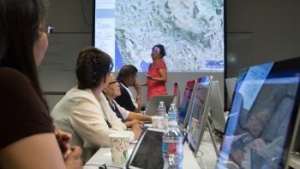
Census Matters Event
At the start of the 2020 decennial census, GRS and SGSUP co-hosted the Census Matters to Arizona Symposium, in partnership with the Knowledge Exchange for Resilience at ASU, the Walter Cronkite School of Journalism at ASU, and the U.S. Census Bureau. The symposium was a unique discussion on how the census affects representation in government, community funding, and the use of data-driven decisions at all levels of society. The keynote speaker was Deirdre Dalpiaz Bishop, the chief of the Geography Division at the U.S. Census Bureau, and other speakers and moderators included experts from SGSUP, journalists, and local government officials.
Geodesign
In 2016, GRS and SGSUP held a Geodesign workshop focused on converging interests in Phoenix’s west valley, which demonstrated the use of Geodesign tools and principles to guide future management of infrastructure, environment, and economy. Geodesign uses GIS for mapping, analyzing, visualizing, and negotiating future land use with a variety of stakeholders, and the workshop used prepared data, spatial analysis, and collaborative discussions and processes to discuss the future of the area. The workshop was led by Dr. Carl Steinitz and Dr. Hrishi Ballal, both internationally recognized experts in Geodesign, and GRS coordinated activities and helped bring together over 40 key participants from a variety of disciplines across the Phoenix area.
Community Planning Training Program for the Navajo Nation
In 2015, a group of planners from the Navajo Nation undertook an intensive 12-day educational training at ASU on how to use Geographic Information Systems and other planning technologies in their community.
GRS helped develop, implement, and teach the workshop which offered the latest techniques and approaches for the Navajo Nation’s regional and local planning needs.
The coursework included GIS and Mapping; Land Use Issues; Grazing and Jurisdictions; Environmental Resources Assessment; Sustainable/Heritage Cultural Tourism; and Transportation Planning. The training has allowed the tribal community to implement the most advanced methods and models in regional planning.
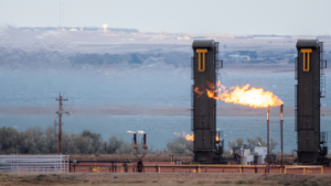
Gaslit
ASU’s Howard Center for Investigative Journalism, an esteemed member of the global investigative journalism network, embarked on the remarkable Gaslit project. This project sheds light on a significant issue: widespread natural gas flaring by U.S. oil and gas operators, intensifying global warming. Policymakers lack precise data on its full extent. To bridge this knowledge gap and present data in interactive maps, the Howard Center enlisted the expertise of GRS's skilled team. GRS offers training in collecting, analyzing, and visually representing spatial data. This collaboration empowers the Gaslit project to provide comprehensive and accurate spatial insights into crucial environmental issues.
GRS in the Classroom and Course Development
The School of Geographical Sciences and GRS faculty and staff have a history of working with other schools and departments to develop classes that teach students how to use GIS/RS technology to support different subject matter areas. Some examples of past classes include:
- GIS Methods for Non-Majors (GIS 494). A 4 credit hands-on course designed for students who are new to GIS and would like to learn how to use it as a tool and apply it to work in their particular studies.
- Interdisciplinary Research Methods II (MCO 591) in the Walter Cronkite School of Journalism & Mass Comm. Students learn to apply interdisciplinary research, observation and production skills in a journalism context. This class includes a section on utilizing basic GIS and mapping in investigative journalism.
- City Studio (GIS499/690). Students contribute to the development and implementation of the City of Tempe’s General Plan 2040 and the 2015 Transportation Master Plan, by creating deliverables for the “20-Minute City Project.” This course focuses on concepts, tools and analysis skills that a GIS professional needs to do professional work.
Degrees and Certificates
The School of Geographical Sciences offers a variety of degrees and certificates associated with geospatial technology and GRS faculty and staff are involved in many of those programs including: