ASU research group helps address critical California sand dune restoration knowledge gaps
Tucked 100 miles south of the Oregon border in Arcata, Calif., lies some of the best remaining native and naturally functioning dune systems on the U.S. west coast, but a lack of localized data evaluating coastal erosion, sea-level rise and potential vulnerabilities to climate change threaten its future existence.
ASU researchers have teamed up with the University of California, Santa Barbara, Humboldt Bay National Wildlife Refuge, the U.S. Fish and Wildlife Service, and a dozen other local and state partners to address the huge knowledge gap and examine coastal dune restoration and management efforts through close-range remote sensing.
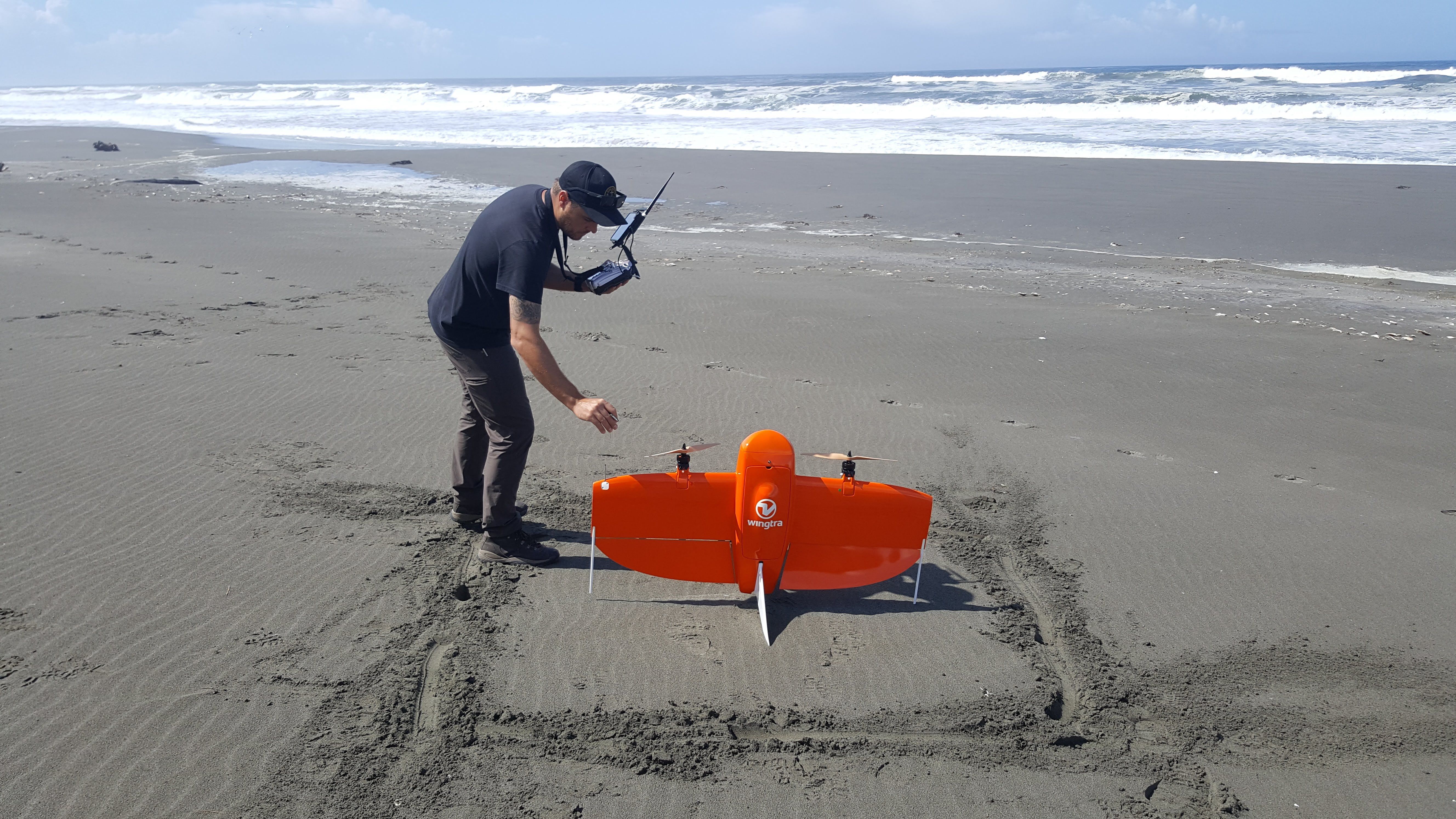
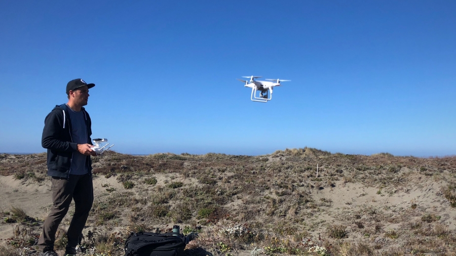
The project, led by UC Santa Barbara Professor of Geography Ian Walker, has partnered with ASU’s Geospatial Research and Solutions to lead assessments of sediment movement along the Eureka littoral cell -- a 32-mile stretch of coastline composed of barrier dune systems -- with a specific focus on the Lanphere dune system using high-resolution terrain mapping technologies.
“Looking at how the dune environment has changed over time can provide valuable information on what we need to do to preserve this area and preserve land in the future,” Craig Turner, laboratory coordinator in the School of Geographical Sciences and Urban Planning, and lead unmanned aircraft system (UAS) pilot and LiDAR technician for the project said.
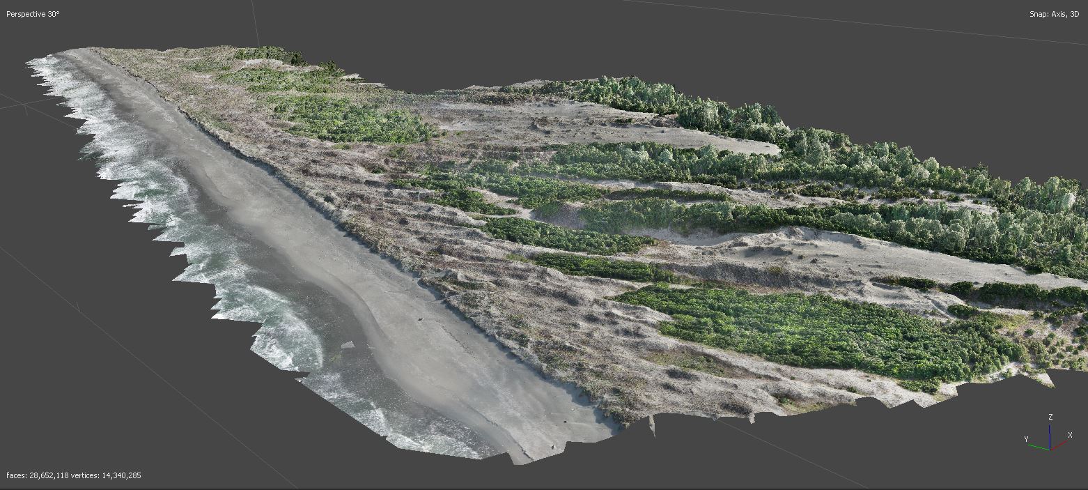
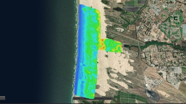
Using UAS, terrestrial laser scanning, and survey-grade GPS at different set intervals over the course of the multi-year campaign, researchers are conducting geomorphic change detection analysis, analyzing how naturally occurring erosion and deposition are changing the Lanphere coastal dune system over time.
“The technologies together allow us to cover large areas of land and yet still retain sub-centimeter accuracy between flight campaigns,” Turner said. “Being able to calculate volumetric change within the area of interest, and quantify how much sediment is moving from say the beach to the foredune and then quantify how much change there is within the vegetation that's growing there is critical to knowing if on-going restoration efforts are working or not.”
Researchers hope to use the information and analysis from this project to inform the development of decision support tools and future coastal dune adaptation measures for sea-level rise and extreme weather events. The project is set to complete in 2022.
ASU’s GRS is also currently conducting work on a second coastal dune restoration project in Oceania, California with UC Santa Barbara and the California Department of Parks and Recreation to assess changing environmental, safety and recreational conditions at the Oceania Dunes State Vehicular Recreation Area (SVRA) and Pismo State Beach (SB).