20-Minute City
Project Type
GIS technology
Status
As part of the City of Tempe’s General Plan 2040, the idea of a walkable, accessible city with a high quality of life for residents has been a priority. GIS researchers at ASU, including Geospatial Research and Solutions’ Shea Lemar, MAS-GIS Program Director and Tempe’s GIS manager Stephanie Deitrick, and other SGSUP faculty and students collaborated to develop a transportation network model for building a “20-minute city.”
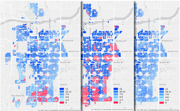
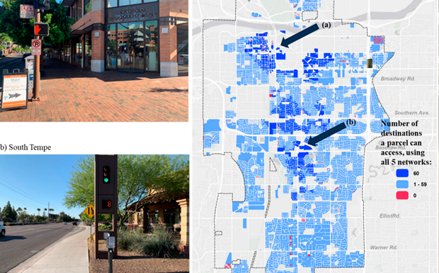
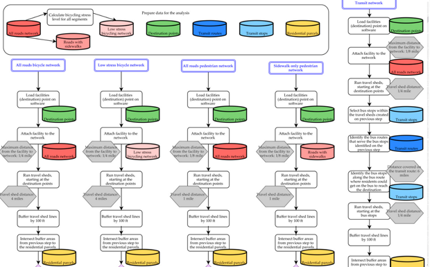
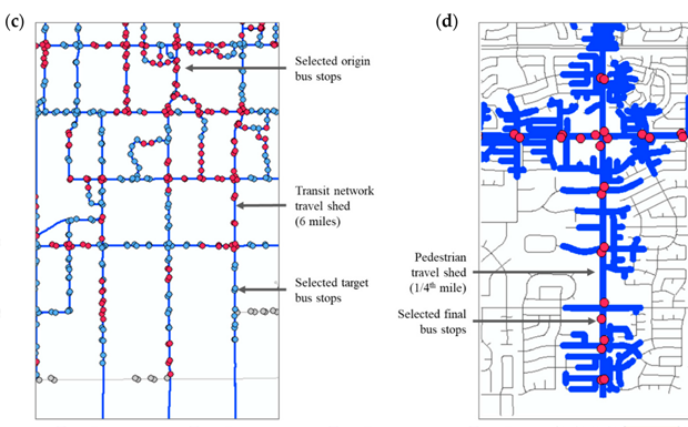
The analysis of transportation requirements for Tempe’s goal of sustainable connections was conducted by modeling travel times using various modes of transport: pedestrian, bicycle, and public transit. The resulting visualization and analysis showed how many residential properties could access city amenities within 20 minutes using those modalities. The network analysis also took into account barriers to walking and cycling, such as major freeways that cross through Tempe, as well as designating “low stress” networks for bicyclists to enhance safety and comfort while riding.
Explore: Sustainability journal article