AZGeo Data Hub
Project Type
GIS technology
Web technology
Status
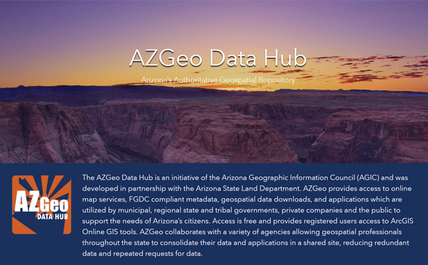
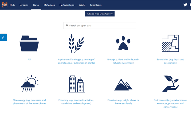
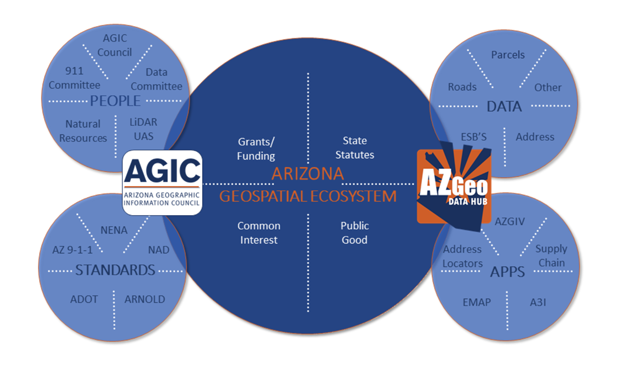
The AZGeo Data Hub project was built in partnership with the Arizona State Land Department and the Arizona Geographic Information Council (AGIC) as a statewide open geospatial data repository. The AZGeo Hub is now the central clearinghouse for geographic information system (GIS) data in the state of Arizona, and enables open access to authoritative spatial data for state and local government, private companies, and the general public. AZGeo also allows for collaboration by professionals to integrate GIS projects and web applications, as well as forming working groups on particular topics.
For registered users, AZGeo provides an authoritative data source for search, view, download, and for usage in ArcGIS Online web maps and applications. The Data Hub serves as a central and verified place for geospatial professionals and various agencies to consolidate data and applications on a shared platform, increasing ease of access across the state for all types of users.
In 2020, GRS was awarded the Geospatial Excellence Catalyst Award for the AZGeo Data Hub project by the National States Geographic Information Council (NSIGC).
Explore: AZGeo Data Hub