AZSite
Project Type
GIS technology
Database
Status
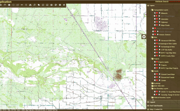
AZSITE is a Geographic Information System (GIS) that serves as a consolidated informational network of recorded cultural resources, including prehistoric and historic sites and properties, and surface surveys within the State of Arizona and a 40 mile buffer around the state. This project features an interactive mapping website to show archeological sites in the state. Developers must determine if there are archeological sites present before they begin excavation.
Originally, archeological site data was housed in 3 different location using 3 different cataloging systems. In the 1990's the University of Arizona, Arizona State Parks Department Historic Preservation Office and Northern Museum of Arizona came together to form the consortium, AZSite. Compiling the 3 disparate datasets has been a long, complicated, and ongoing task. A GIS was created to store unique site information. An interactive map that is secured by login/password allows users to identify potential historic sites within a construction zone. The technology used to create the AZSite internet mapping has evolved from humble beginnings using ArcIMS to a full-fledged enterprise system that now uses ArcGIS Server. The data for this project resides within an SQL database that utilizes ArcSDE to display statewide data for elevation and 7.5’ digital ortho quarter quads, 1:24K topo maps in the context of archeological sites. The system continues to be reviewed by users and enhancements are being continually developed by GRS.
Explore: AZSite