Census Data for Research
Project Type
GIS technology
Status
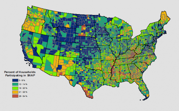
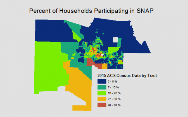
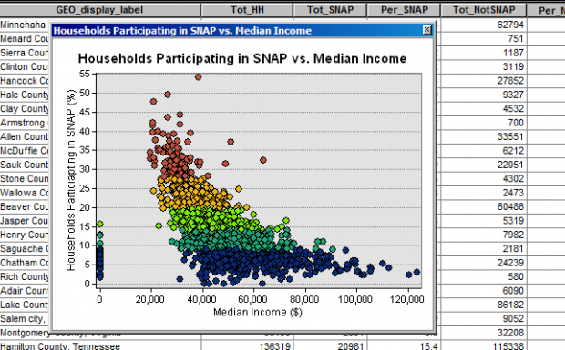
GRS is often asked to obtain census data for researchers. This is one example of the types of projects we have done with census data. The Supplemental Nutrition Assistance Program (SNAP), formally known as “food stamps”, was originally created to help low-income families purchase enough food to provide nutrition for their families. It is aimed at lo- income families and is attributed to cutting extreme poverty in the U.S. in half. The client wanted to be able to see and present accurate data for how many households are participating in the SNAP program. 2015 census data for this project was requested at the county level, which was gathered from the U.S. Census and the U.S. American Community Survey. Geospatial Research and Solutions needed to find the information, process it, and use it to create a map that showed the percent of the U.S. population participating in SNAP at the county level.
Census data is available via census.data.gov, and GRS can process these large amounts of data in the form of tables and shapefiles to be suitable for use with ArcGIS, and perform tabular joins and spatial analysis on that data.