Connectivity and Conservation
Project Type
Status
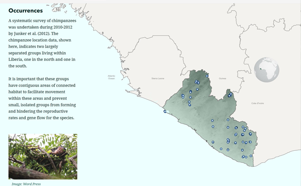
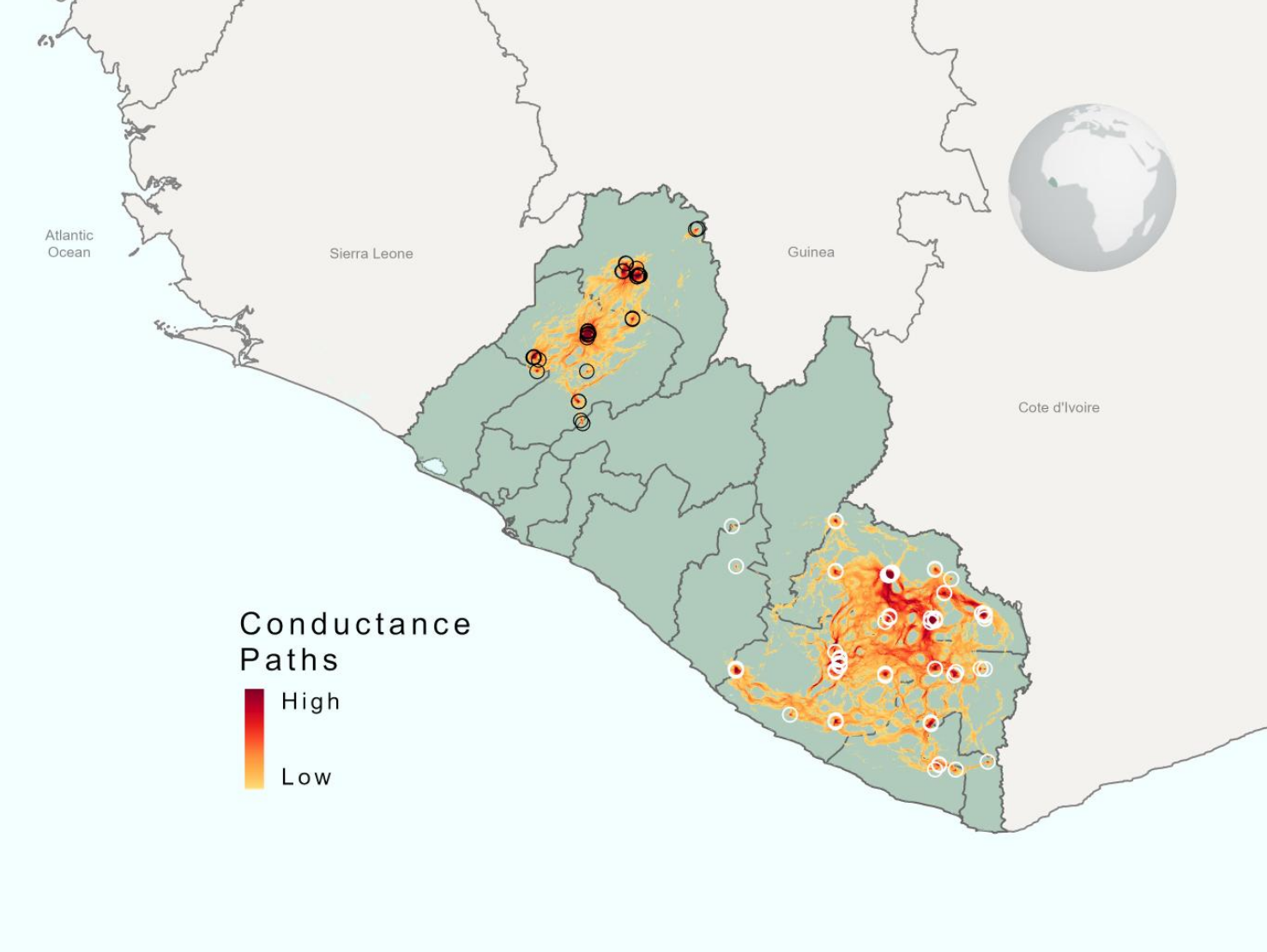
Working in collaboration with Conservation International, Associate Director of GRS Amy Frazier led research to better understand the makeup of western chimpanzee habitats at large spatial scales, including how potential habitats connect with one another for breeding, where they fall in relation to existing protected areas, and if there is overlap with current land-use for agriculture, industry, and infrastructure development.
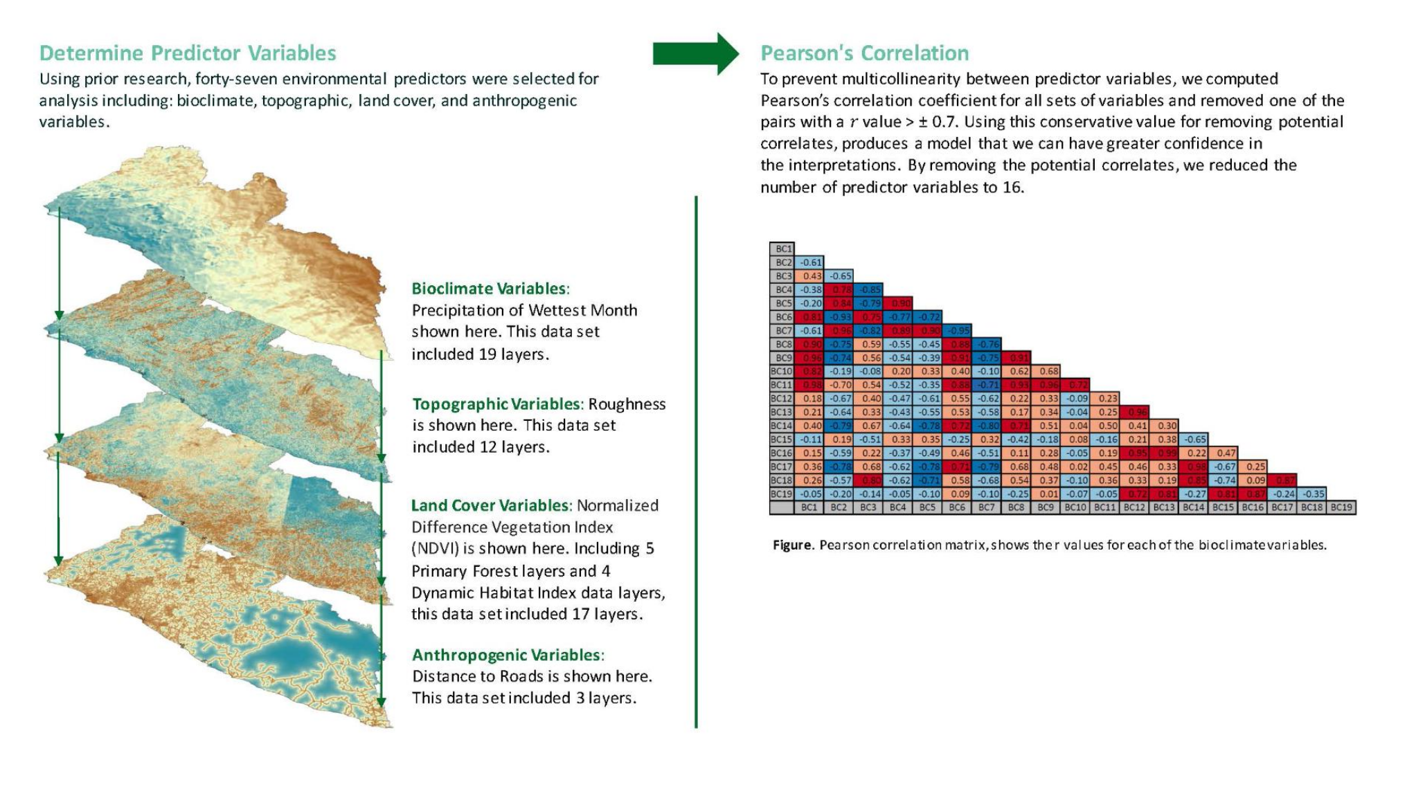
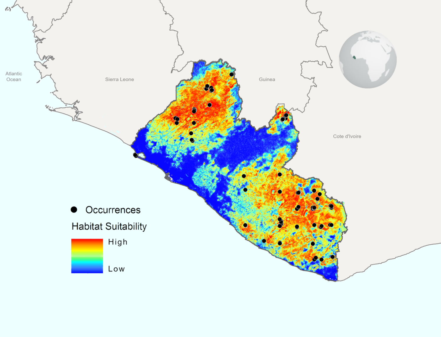
In the research, Frazier and her team analyzed and compared more than 40 layers of data spanning remotely sensed geographic information, chimpanzee occurrence points, and climate variables to best understand chimpanzee habitat suitability and connectivity across Liberia. They then produced a series of detailed maps visualizing the areas most suitable for western chimpanzees, how the areas are connected with one another, and where they overlay with existing protected areas and areas currently earmarked for natural resource extraction.
With a better spatial understanding of western chimpanzee habitat suitability and connectivity, this research can play a critical role in aiding the way land managers and decision-makers rethink conservation priority.