Data Collection and Creation

Project Type
Data Collection and Creation
Status
Active
Summary
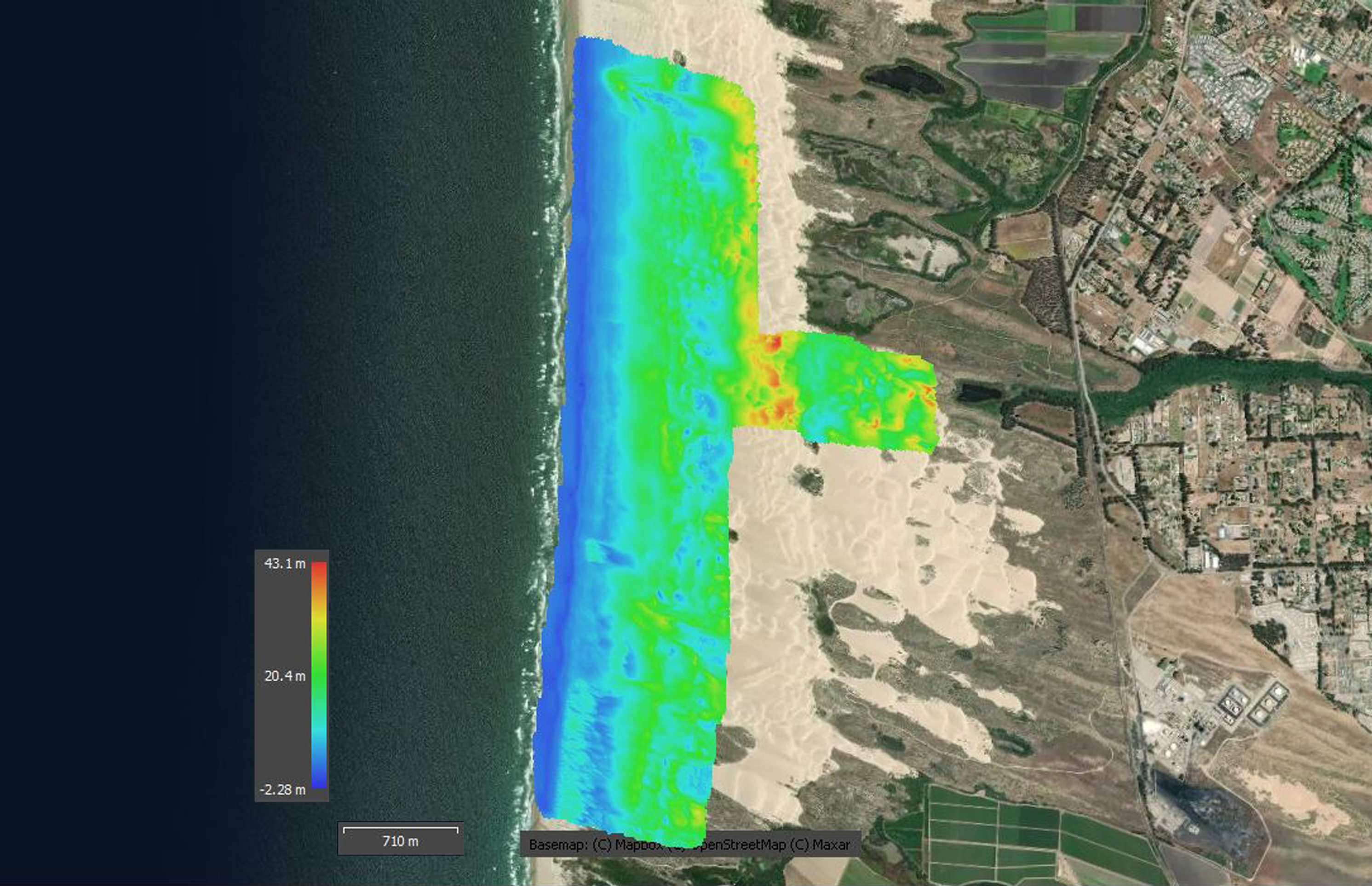
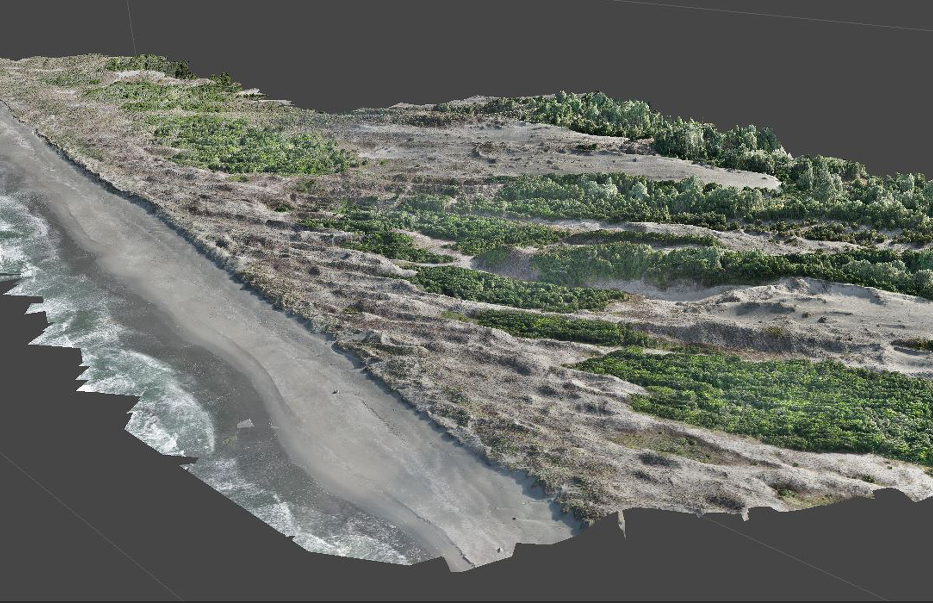
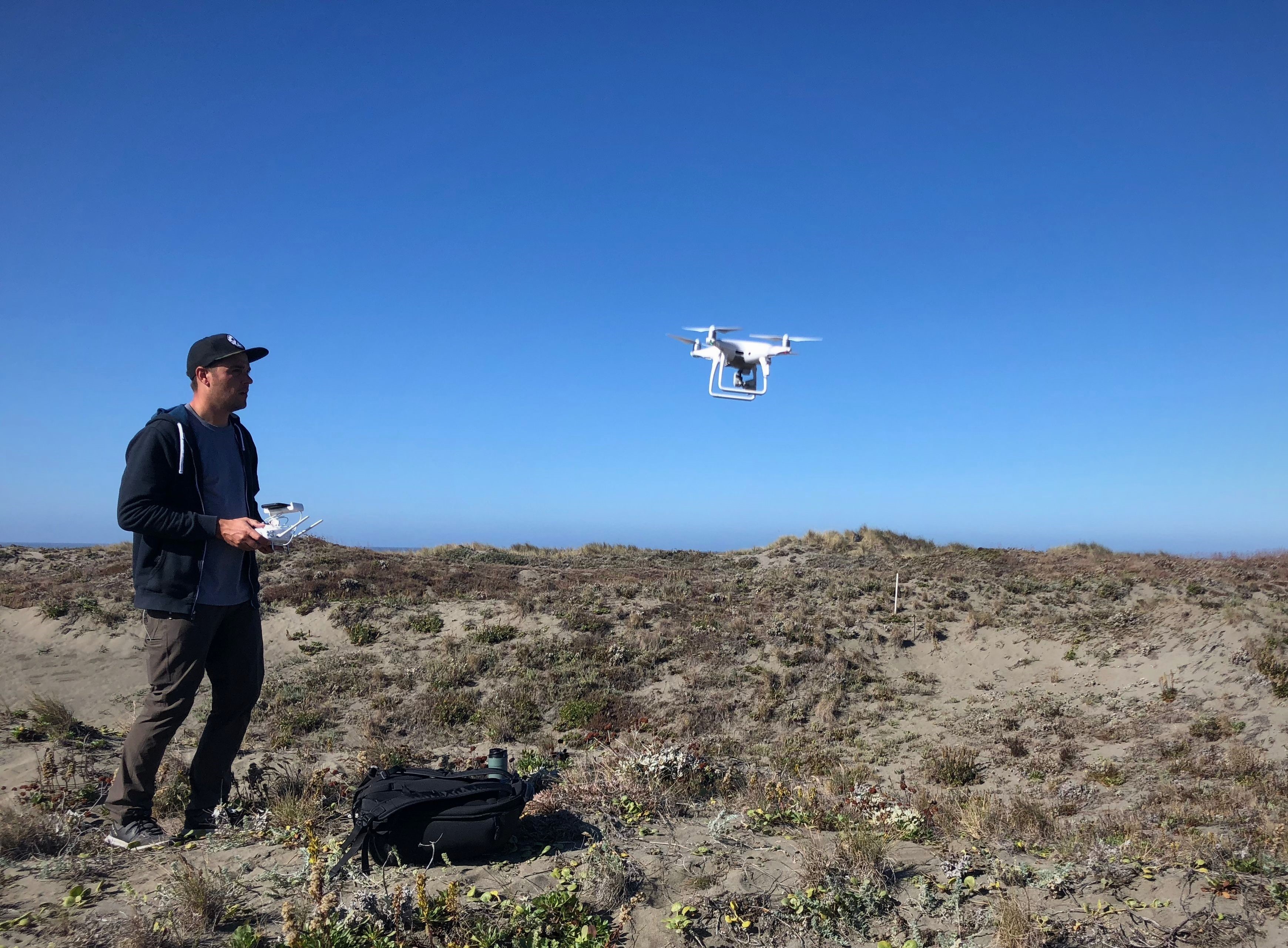
GRS works with/for a wide variety of clients to collect field data to meet their needs. When clients need points, lines, and polygons collected the GRS team often utilizes their iPads paired with survey grade level GPS units to gather data at the centimeter level. They also have their own Trimble GNSS system that can deliver survey grade accuracy. For remotely sensed data the team utilizes their UAS to fly areas and gather RBG and multispectral data which also has survey grade accuracy. The team can export their remotely sensed data as DEMs, DSMs, 3D models, orthomosaic scenes, and more. In addition, they create 3D models from data they gather with their terrestrial LiDAR.
Explore: GRS Equipment