Distance Analysis
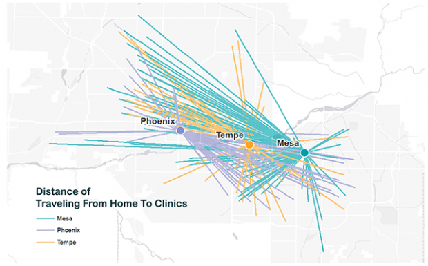
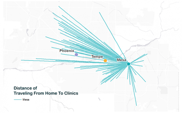
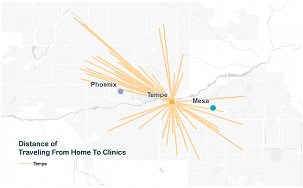
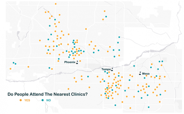
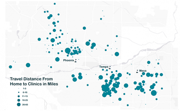
GRS often does various types of distance analysis, and this is an example of a project to visualize how people were setting appointments across facilities in the Valley, with the data returned as a table for further analysis. 2,000 address locations and facility addresses were geocoded and mapped in order to show the overall distance each person traveled to get to their desired facility and analyze ratios of patient travel patterns. Some facilities showed much higher attendance rates than others and the client wanted to see if people were going to the facility nearest to their house, or driving extra distance and if so, the client would try to determine why.
The data were joined with US Census American Community Survey (ACS) block group data in order to see the general demographics of the community, and for the researcher to continue analysis based on both the GRS-produced maps and tabular data.