Drought Map Automation
Project Type
GIS technology
Status
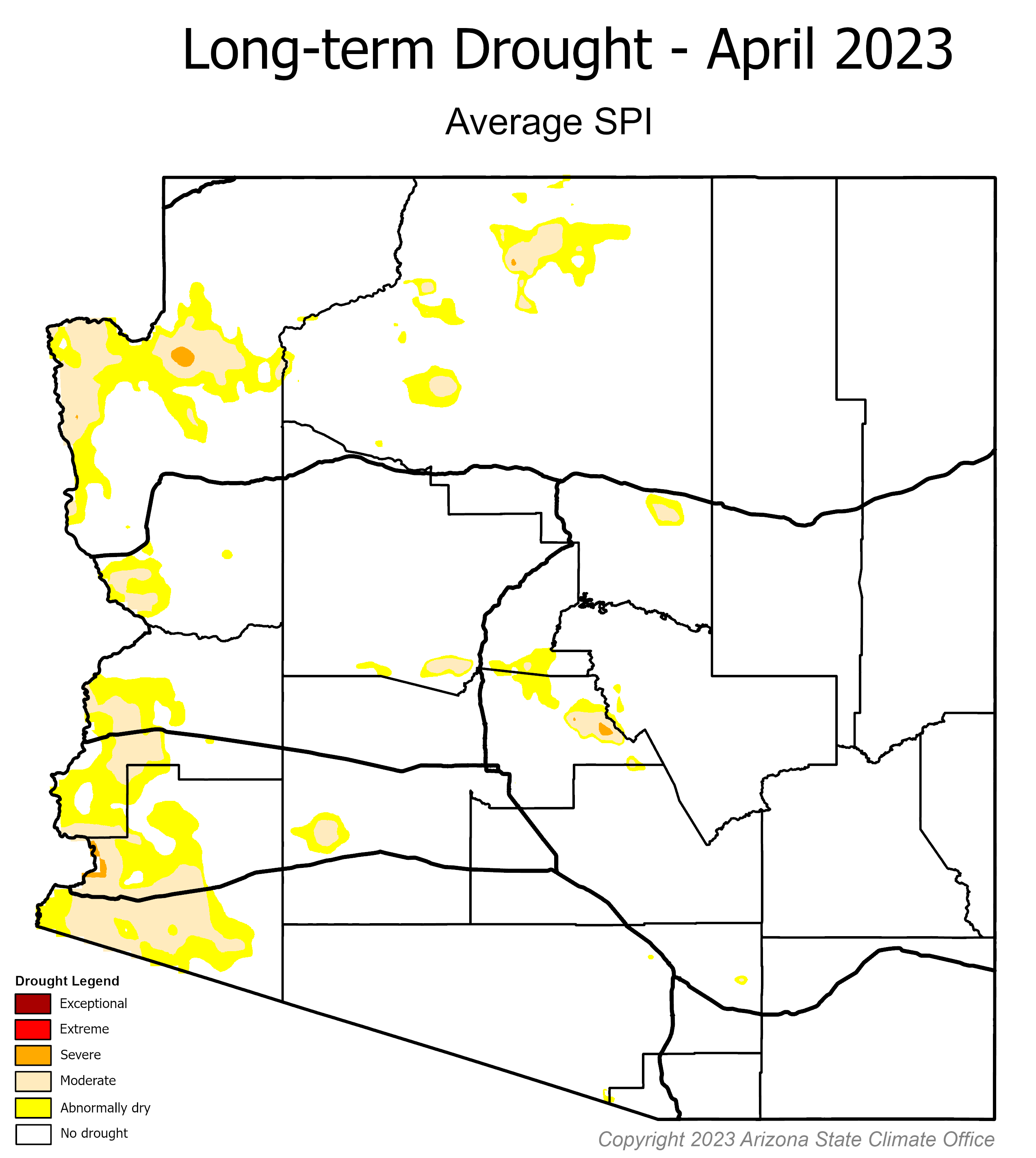
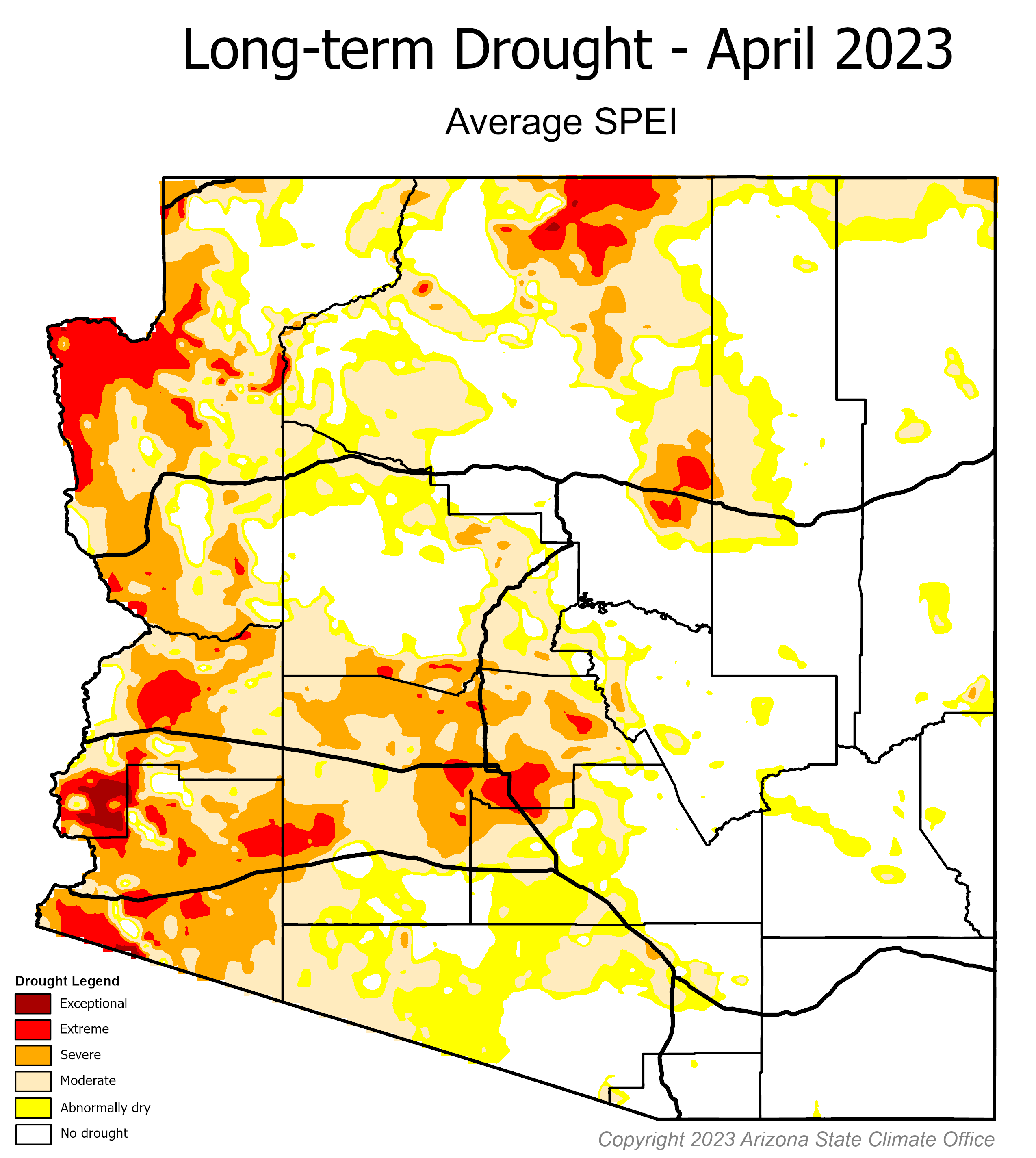
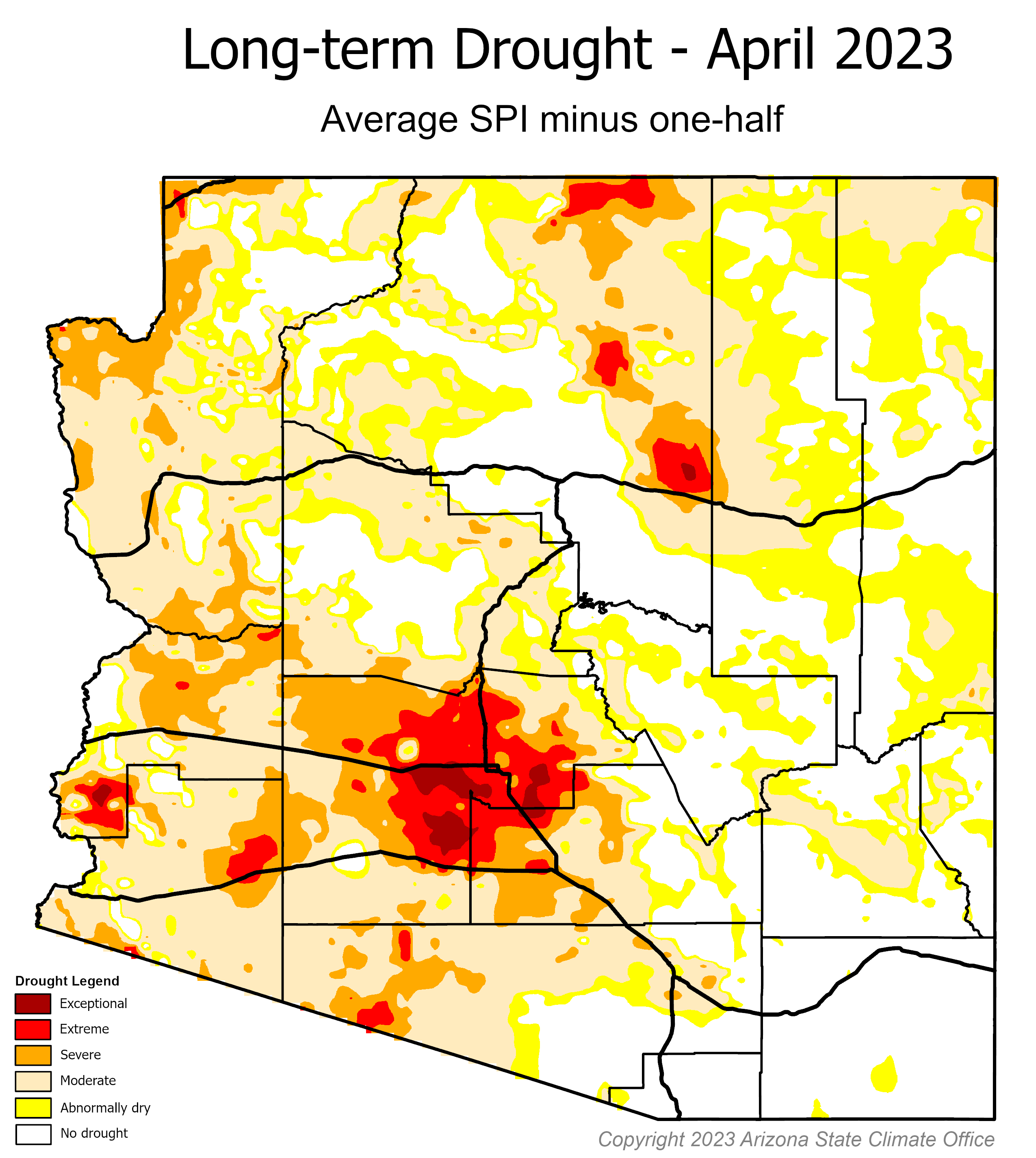
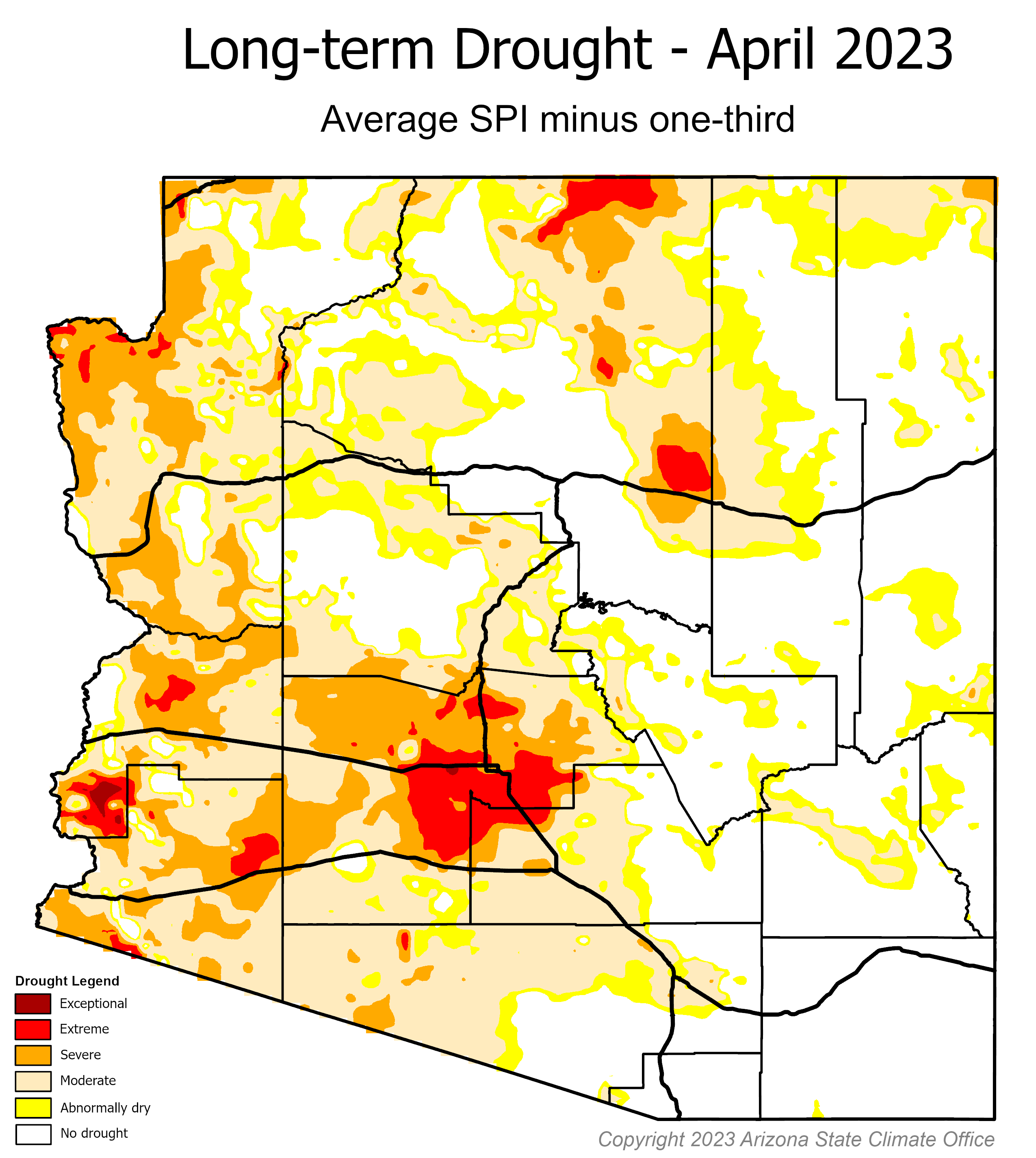
The Colorado River Basin has been grappling with a persistent drought for the past 22 years, while the state of Arizona has endured a long-term drought for an even longer period of 29 years. Recognizing the severity of the situation, the Arizona State Climate Office took the initiative to study and devise methodologies for assessing short- and long-term drought conditions within the state. In this endeavor, the Geospatial Research and Solutions team was entrusted with the crucial task of automating the creation of long-term drought maps. These maps are developed using netCDF files that incorporate the Standardized Precipitation Index (SPI) and the Standardized Precipitation Evapotranspiration Index (SPEI). By considering multiple timescales and integrating deficits and surpluses over extended periods, these maps enable water managers to gain a comprehensive understanding of the prevailing drought conditions.
The significance of these long-term drought maps is evident through their regular presentation at the Arizona Department of Water Resources (ADWR) Drought Monitoring Technical Committee meetings on a quarterly basis. Additionally, they are shared biannually with the ADWR Drought Interagency Coordinating Group. These maps serve as critical tools for making informed recommendations aimed at addressing Arizona's ongoing drought crisis. Consequently, they play a pivotal role in shaping water management strategies and actions throughout the state. To update the long-term drought status map for Arizona, the Geospatial Research and Solutions team analyzes precipitation and streamflow percentiles over the past 24, 36, 48, and 60 months, comparing them against a 40-year historical record. The resulting map is then utilized by the Arizona Drought Monitoring Technical Committee to draft comprehensive reports.
Explore: Drought Status Reports and Maps