Mapping 10X
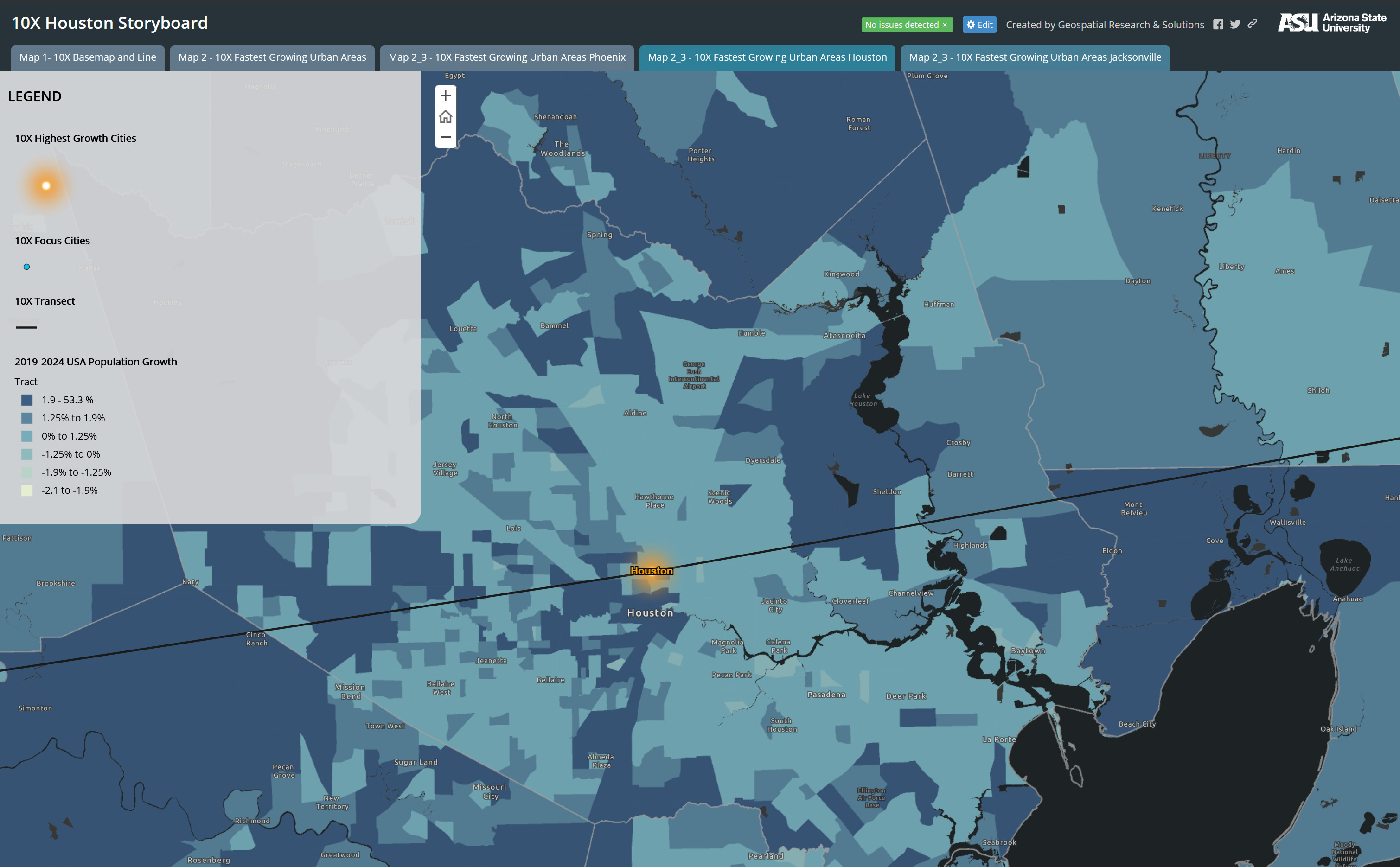
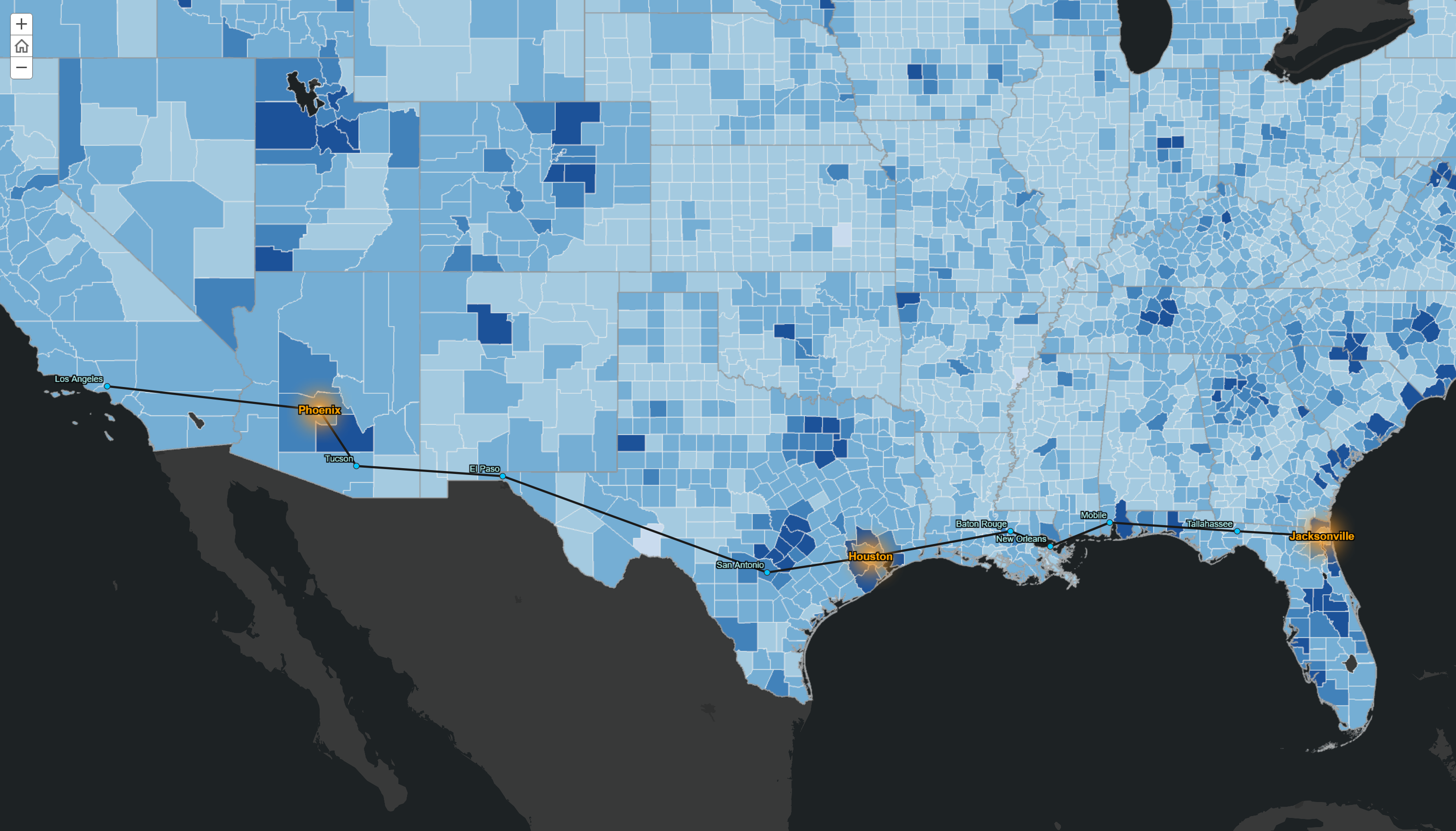
10X is proposed as a platform to achieve a more sustainable and inclusive society by unstable present condition reviews and decision-making optimization. GRS created a storyboard to frame the “emergent” and most rapidly expanding portion of the nation. By bringing 10X highest growth cities and focus cities into sharp focus through exploratory mapping, 10X will have a better understanding about how to build and expand a durable collecive interest nerwork amongst the country.
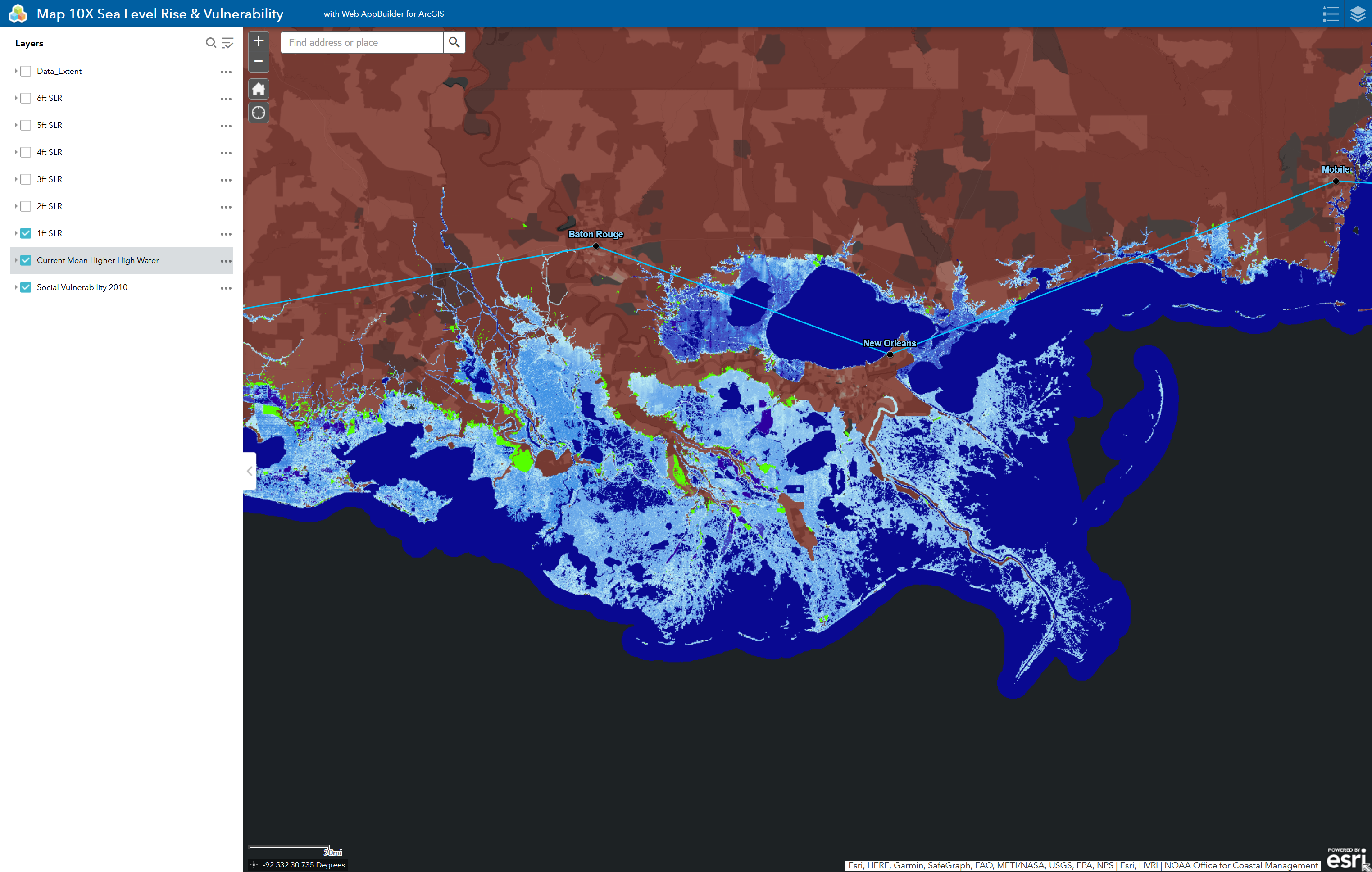
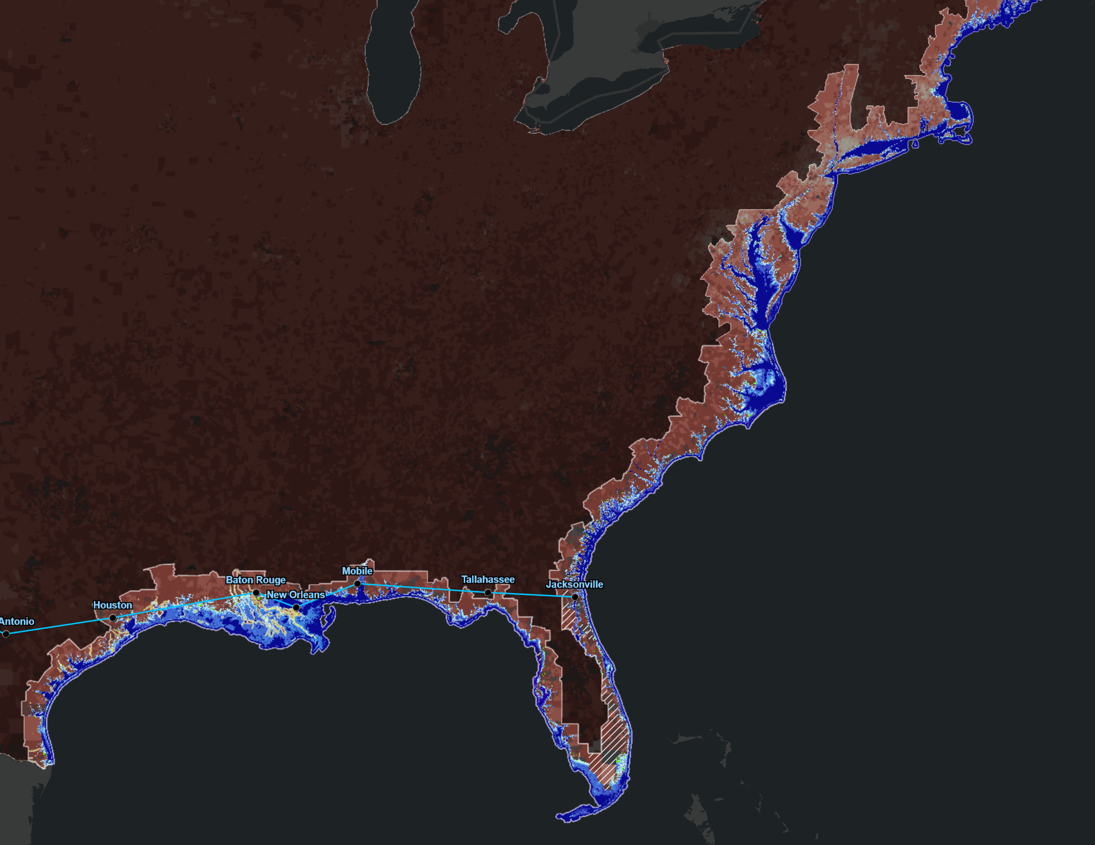
The interactive web application serves as an exploratory mapping tool for 10X participants who shows considerable interest in estimates of sea level rise and social vulnerability. This research will not only benefit the future survival of the coastal communities, but have applications to other regions and communities around the world.
Explore: 10X Storyboard, Map 10X Sea Level Rise & Vulnerability