Mapping Desert Foothills Park

Project Type
Status
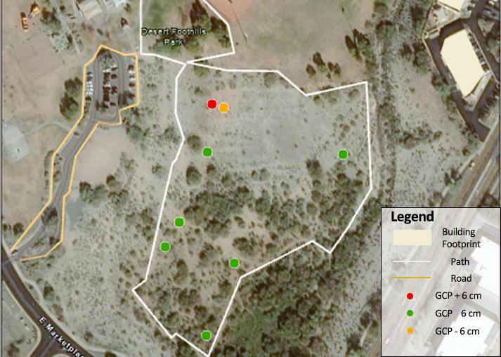
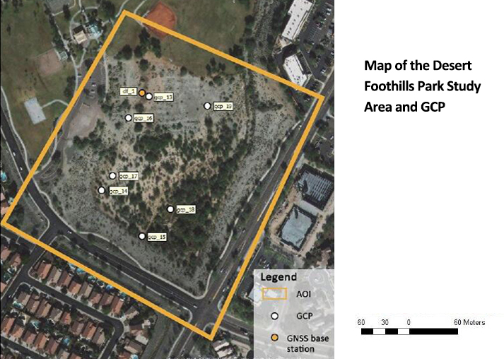
Desert Foothills Park is located in Phoenix near Chandler Blvd and Desert Foothills Parkway. This park serves as a floodwater retention basin for the surrounding community. The Mapping Desert Foothills Park project involved designing and implementing vector field-data collection (utilizing an iPad and Bed Elf GPS) as well as a UAS-based SfM-MVS photogrammetry survey of this site. GRS faculty and staff work with a wide variety of clients to collect field data in similar ways to meet a variety of needs.
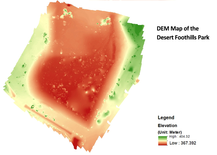
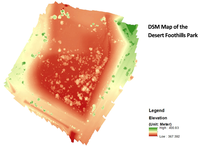
For vector data collection (points, lines and polygons) GRS uses mobile devices such as iPads that pair with GPS devices to capture assets and perform inspections. Those field-captured data are brought into enterprise GIS systems via work in ArcGIS Server or ArcGIS Online. For raster data collection, GRS utilizes UASs with RGB and multi-spectral cameras to collect aerial photography and other raster data. Those data are used to create DEMs, DSMs, 3D models, orthomosaic scenes, and other products.