Mapping Invasive Vegetation
Project Type
Status
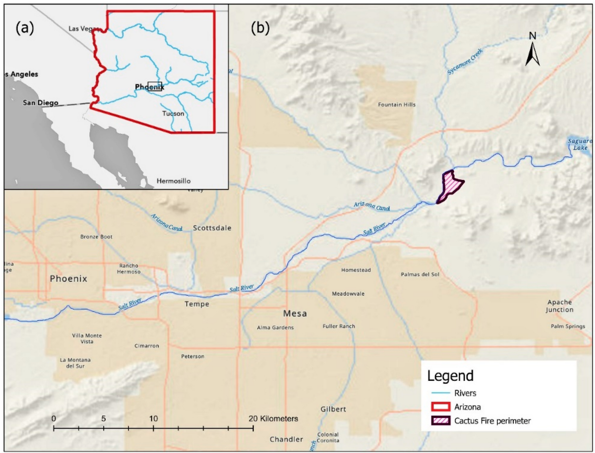
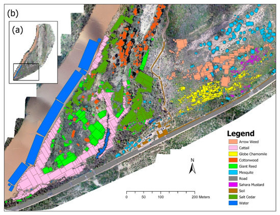
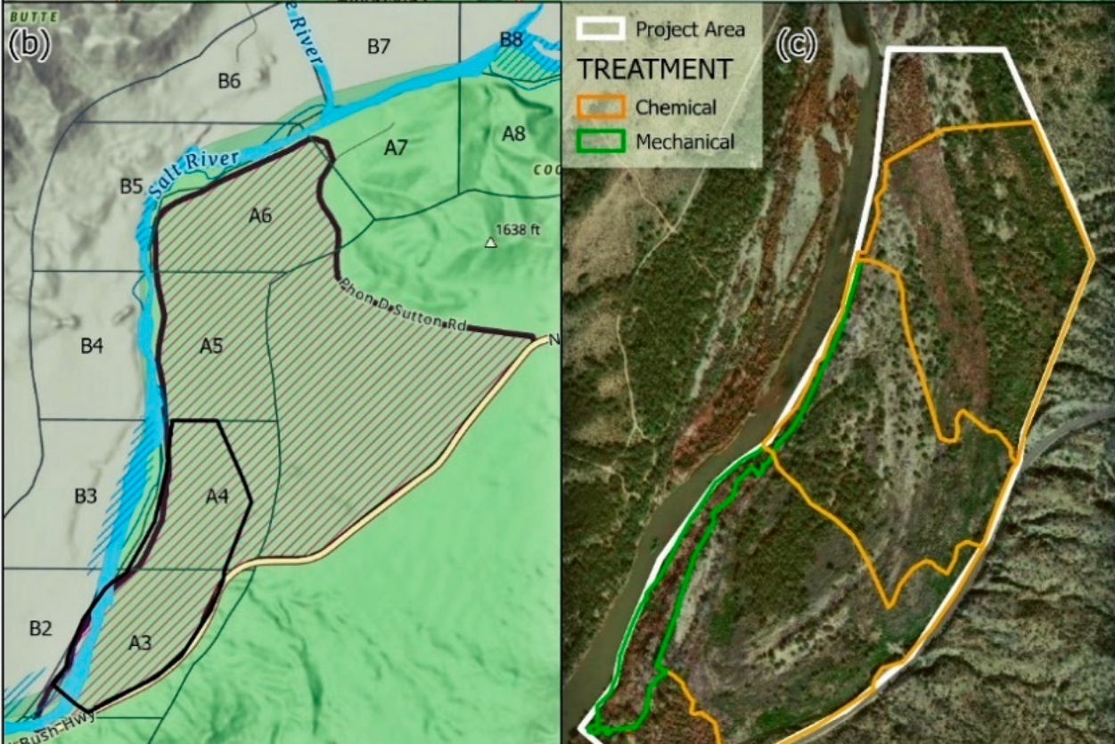
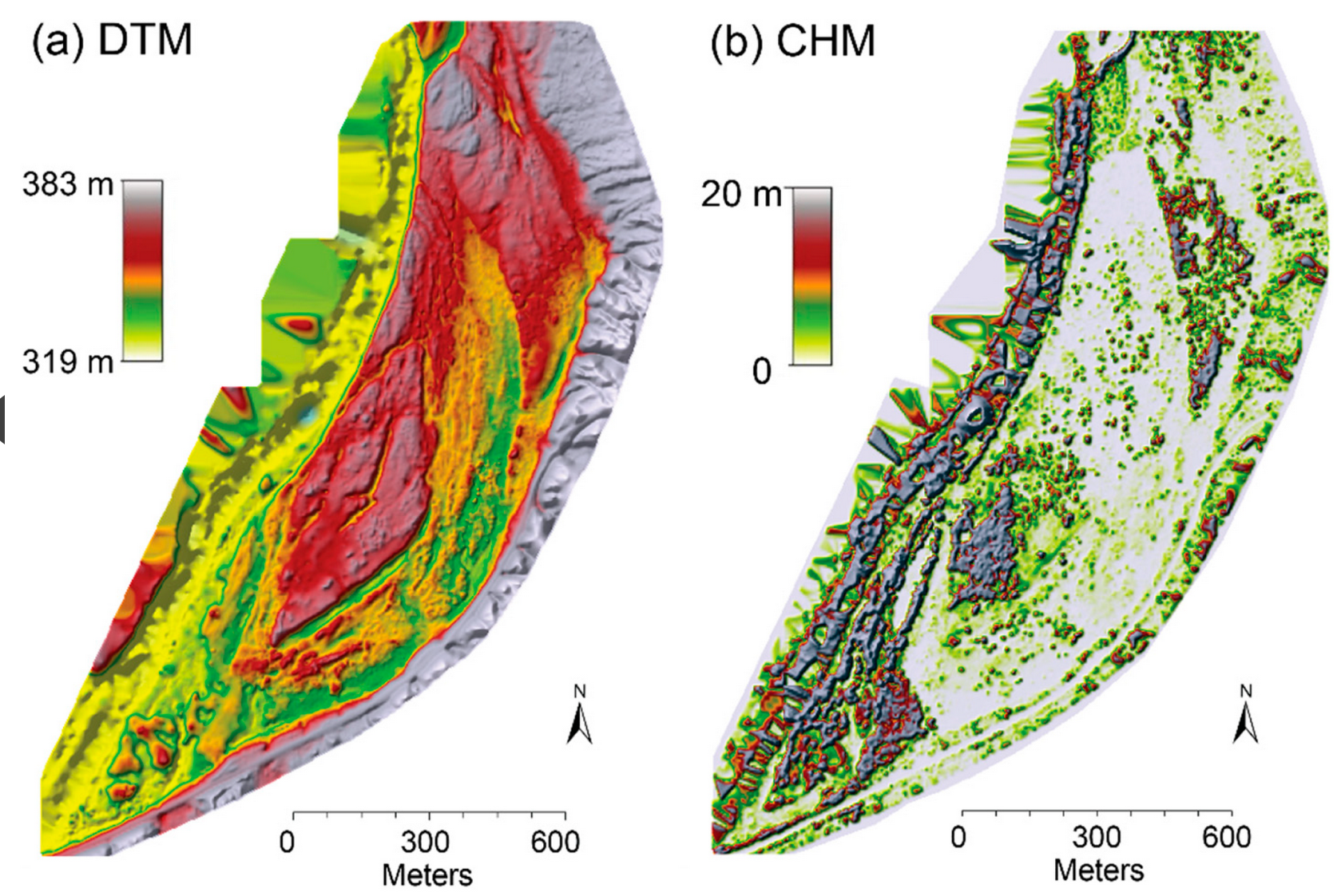
In 2017, the Cactus Fire ignited and burned 331 hectares in the Tonto National Forest along the Salt River, creating ideal conditions for colonization by invasive species. Recognizing the potential for negative outcomes to the ecosystem after the cactus fire, Tonto National Forest personnel along with agencies such as the National Forest Foundation and Northern Arizona University have been actively managing the site - known as the Lower Salt River Restoration Project - to prevent the spread of species such as giant reed and saltcedar and encourage regrowth of native species. However, land managers have been unable to assess the vegetation composition in many parts of the river channel because the terrain is rough and the vegetation is dense. Without first-hand knowledge of the distribution of vegetation in these areas, management activities (e.g., mechanical removal of invasive species) cannot be planned or executed. UAS offer an ideal tool to collect quality data from these inaccessible areas for ecosystem assessment.
Students from ASU's MAS-GIS program worked with Tonto National Forest personnel to collect data in the area using drones. Those students went on to work with Dr. Amy Frazier to develop an an integrated spectral - structural workflow for classifying invasive vegetation species which improved the overall accuracy from 80% to 93%. This newly developed process is now being implemented in the continuing Lower Salt River Restoration Project.
Explore: Drones in Geography Article