Ten Across StoryMaps
Project Type
GIS technology
Web technology
Status
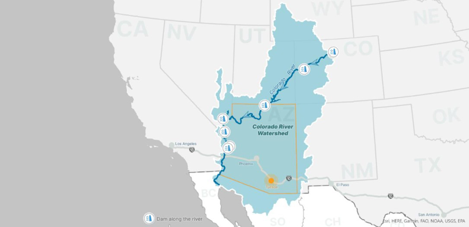
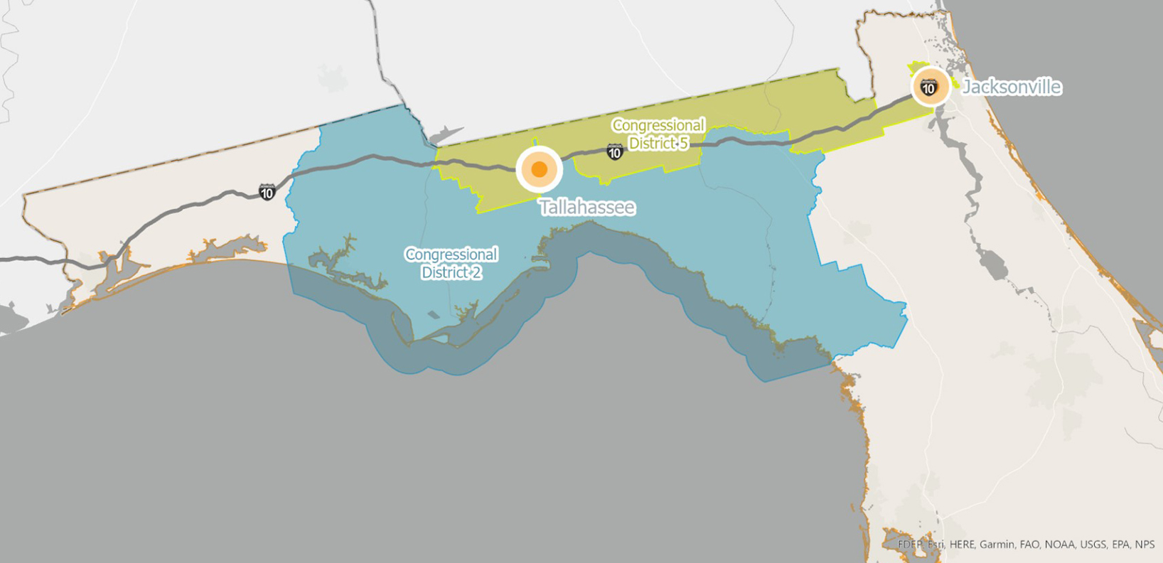
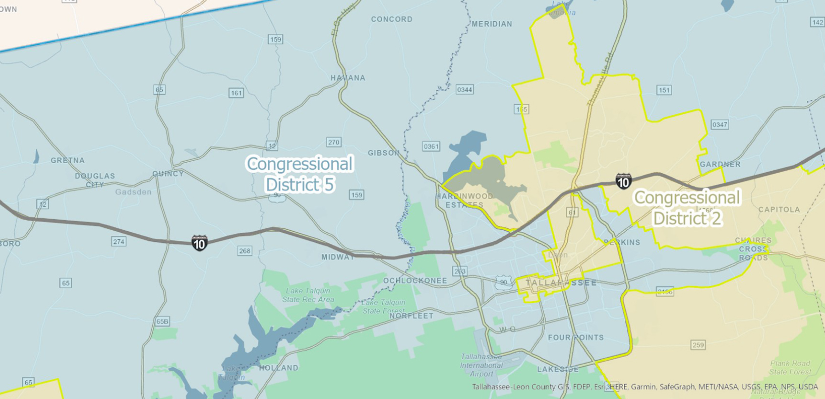
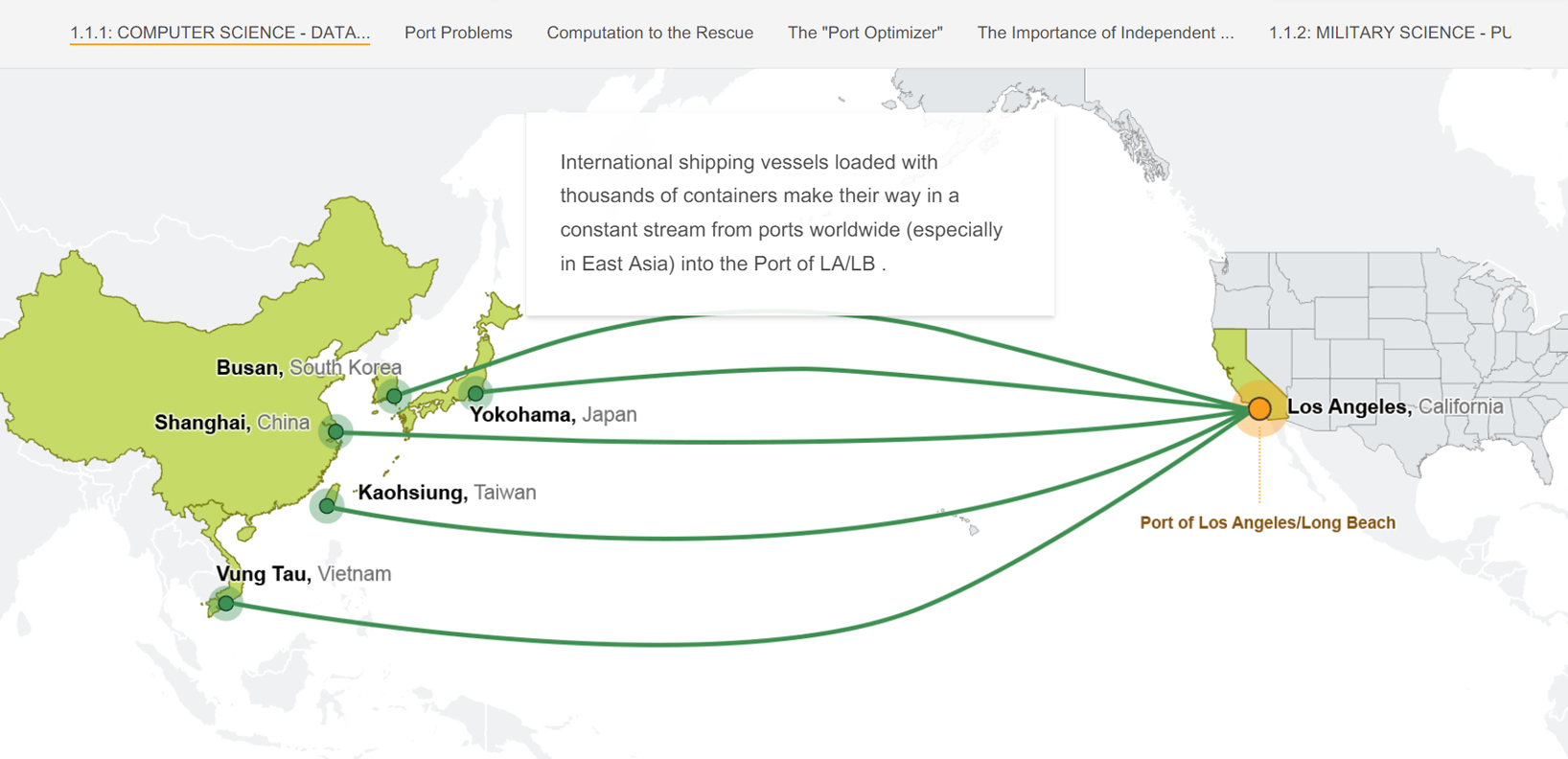
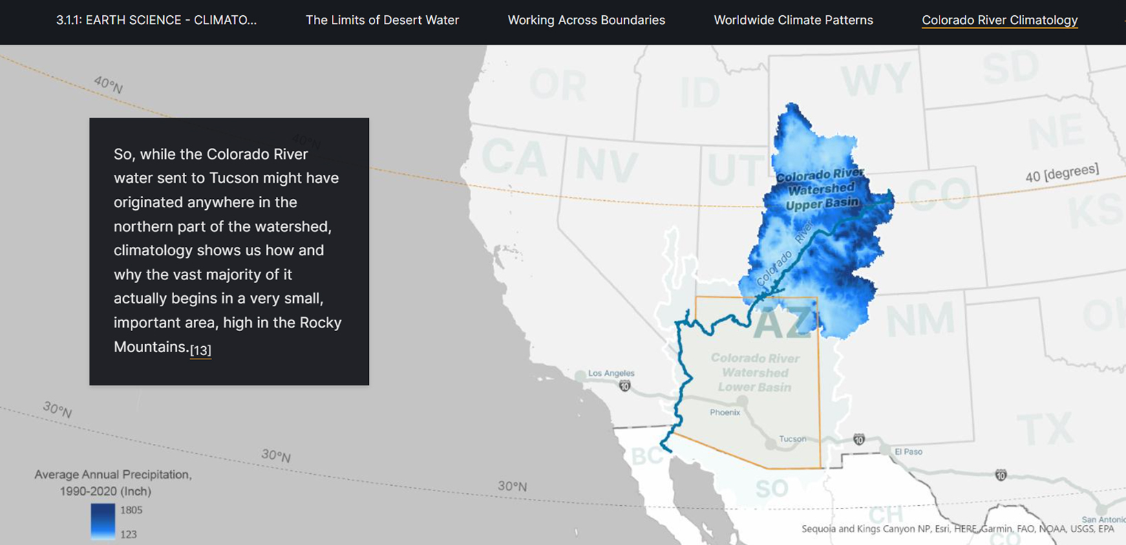
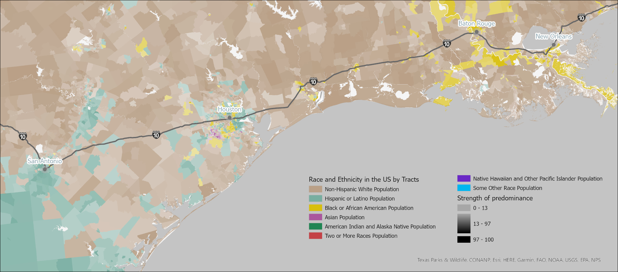
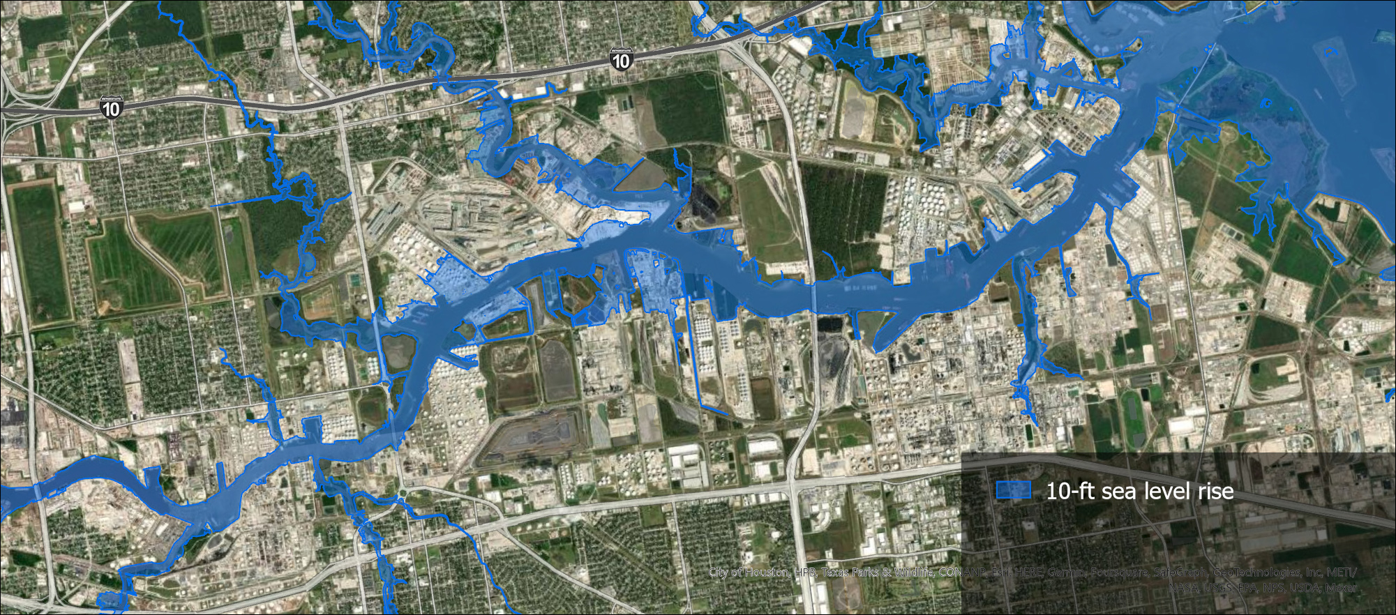
America’s 2,400-mile Interstate 10 highway most acutely represents the frontline of our shared future. Connecting the fastest growing, most demographically diverse, and most disaster-vulnerable U.S. cities from Los Angeles to Jacksonville, the I-10 provides a living observatory for understanding the present and envisioning more sustainable and inclusive futures. Pressing resilience problems impacting I-10 communities are well-documented in contemporary media and provide a rich resource for students to investigate how lives, communities, and ecosystems are being impacted by climate change, social inequity, and other forces. The Resilient American Futures course allows students to study these narratives and provides the academic content that helps contextualize them. This course was built entirely in Esri’s StoryMaps. GRS worked with ASU’s Ten Across team to develop a StoryMap template for the class and over one hundred maps for the project.