Turkana Data Project


Project Type
GIS technology
Status
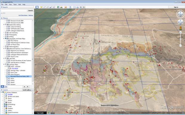
Geospatial Research & Solutions is working with Dr. Robert Raynolds, research associate at the Denver Museum of Nature & Science, to develop a Google Earth application for the Turkana Basin project. Lake Turkana, located in northern Kenya in the Great Rift Valley, is the world’s largest permanent desert lake and is regarded as the “cradle of humankind” due to the abundance of hominid fossils. The client was in need of a way to allow a disparate group of researchers to see the variety of spatial data that is available for the Lake Turkana Basin area. There was a portion of the research data that needed to be mapped, turning it into GIS data, and then delivered in a format easily consumable by different mapping interfaces. Geospatial Research & Solutions created a GIS database from a large variety of Turkana Basin research data and then created KMZ files that could easily be consumed by the Google Earth application.
This application was designed to bring together research data from a variety of researchers, allowing them to post and share data using the Google Earth desktop application. Some of the data in the repository include dinosaur and hominid fossils, hominid reconstructions, photos, paleomagnetic lines, radiometric dating, cross sections, and more. The application is also used as a resource to teach local Field Schools about the paleontology, archaeology, and ancient environment of the Lake Turkana Basin.