
Equipment
GRS has both software and hardware suitable to meet all geospatial needs for GIS, remote sensing, and LiDAR, operated by experts trained and certified to work with these technologies. Our equipment ranges from top-of-the-line UAS (Unmanned Aircraft Systems, drones) to ground survey equipment to handheld GPS units for all levels of data collection and research support. Certain pieces of equipment require trained GRS staff to operate. Please contact GRS if you are interested in learning more.
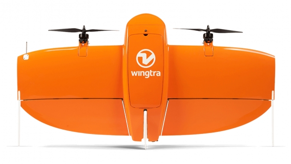
WingtraOne Fixed Wing UAS
Technical details
• Used for large scale survey areas,
• Survey grade accuracy (cm-scale),
• RGB Camera: Sony RX1RII 42MP ,
• Multi-Spectral Camera: Micasense RedEdge MX, 5-band multi-spectral sensor
Used for large-scale survey areas, the WingtraOne provides high-resolution, georeferenced orthophoto imagery mosaics, Digital Elevation Models (DEM) and DSMs at centimeter accuracy.
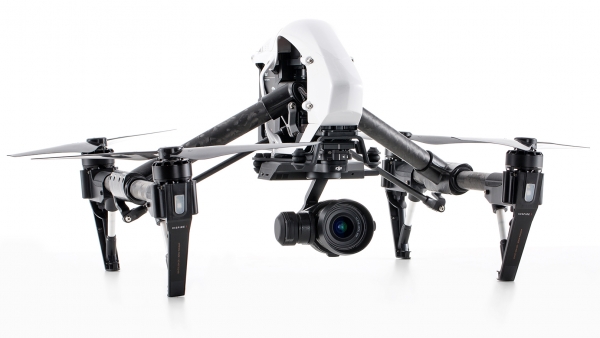
DJI Inspire 1 UAS
Technical details
• Used for mid-scale survey areas,
• Survey grade accuracy (cm-scale),
• Zenmuse XT Thermal Camera
Used for mid-scale survey areas, the DJI Inspire 1 provides high-resolution thermal mapping at centimeter accuracy.
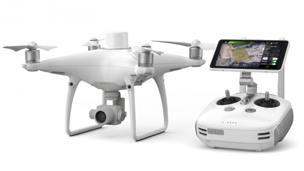
DJI Phantom 4 Quadcopter UAS with RGB camera (20MP)
Technical details
• Used for mid-scale survey areas,
• Survey grade accuracy (cm-scale),
• RBG Camera: 20MP
Used for mid-scale survey areas, the DJI Phantom 4 provides high-resolution, georeferenced orthophoto imagery mosaics, Digital Elevation Models (DEM) and DSMs at centimeter accuracy.
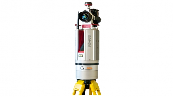
Riegl VZ-400i Terrestrial 3D Laser Scanning System (LiDAR)
Technical details
• Provides colorized point clouds and digital surface models,
• Survey grade accuracy (mm-cm scale),
• Multiple return (4 or 5) sensor with full-waveform capabilities,
• Onboard RTK-DGPS,
• Onboard RGB camera
The Riegl VZ-400i is a terrestrial 3D laser scanning system with multiple return sensors and full-waveform capabilities to provide colorized point clouds, used for ground-based surveys with survey grade accuracy (mm-cm), in addition to the standard secondary data products.
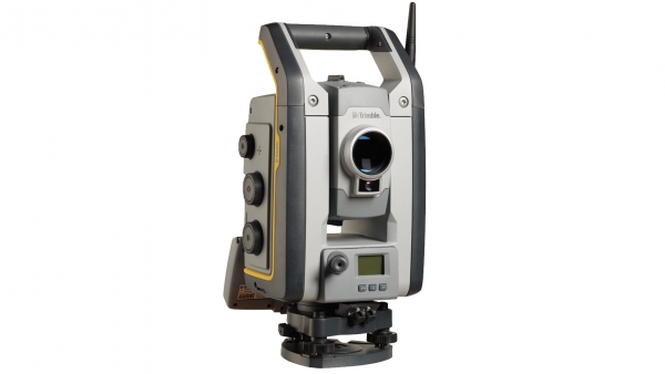
Trimble S7 Total Station: Scanning, Imaging, Surveying System
Technical details
• Used for areas with limited satellite availability,
• Survey grade accuracy (mm-cm scale),
• Creates 3D models and high accuracy DTMs
An all-in-one imaging, surveying, and 3D scanning system often used for areas with challenges posed by limited satellite availability. Used to create 3D models, high accuracy visual site documentation, point clouds, and more.
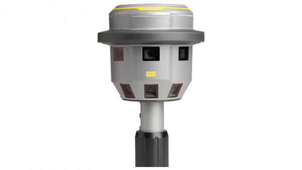
Trimble V10 Imaging Rover
Technical details
• On-ground structure from motion/multiview stereo photogrammetry,
• 12 calibrated cameras that capture 360-degrees 60 MP images,
• Integrated with our R10 GNSS to deliver survey grade accuracy (cm scale)
The Trimble V10 Imaging Rover is an integrated camera system that precisely captures 360 degree digital panoramas for efficient visual documentation and measurement of the surrounding environment.
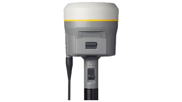
Trimble R10 Integrated GNSS System
Technical details
• High accuracy (mm-cm scale) land surveying system
The Trimble R10 Integrated GNSS system is used in conjunction with our other hardware to ensure accurate data collection.