Projects
GRS has won multiple awards for their work on research projects with faculty as well as external partners such as government agencies, utilities, and other non-profit organizations. We have over 30 years of experience working with a wide variety of Geographic Information Systems software, data, and geospatial data management tools including Esri, Google, Open Layers, SQL and SDE.
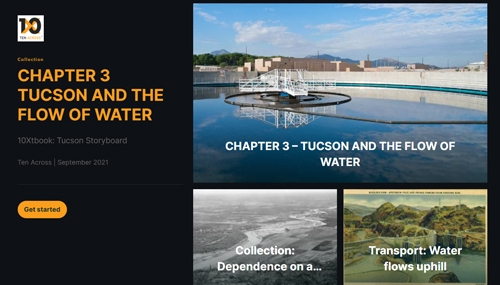
Ten Across StoryMaps
Ten Across collaborates in the cultivation of understanding of the people, places and challenges throughout our unique and varied region, and creates opportunities to share the expertise necessary to drive transformative change. GRS worked with Ten Across on their Resilient American Futures course which focuses on the narratives of the area.
Colorado River Water Use
ASU's pioneering study in the Colorado River Basin quantifies water usage by coal-fired power plants and mines. It identifies water rights' volume, sources, and ownership. The research aids policymakers and communities in managing water resources during coal facility closures. GRS assisted with geospatial data and maps for public communication.
Paideia Academies 3D Modeling
Through comprehensive data capture and advanced 3D modeling, GRS presents an interactive digital campus for Paideia Academies, offering a precise visualization tool to support strategic planning, spatial analysis, and community engagement. This project exemplifies how geospatial technology can enhance understanding and foster informed decision-making for educational institutions.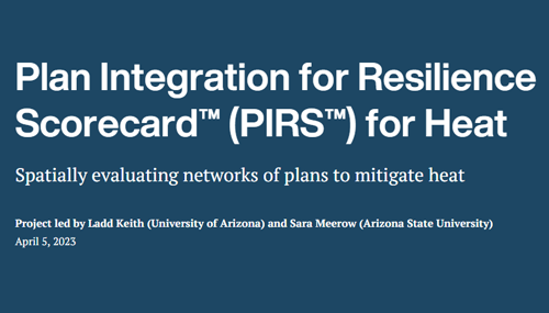
Plan Integration for Resilience Scorecard™ (PIRS™) for Heat
Communities everywhere must increasingly plan for urban heat resilience. The PIRS™ for Heat is an approach that communities can use to analyze how heat mitigation policies are integrated into different plans and to identify opportunities to better target heat mitigation policies in high heat risk areas.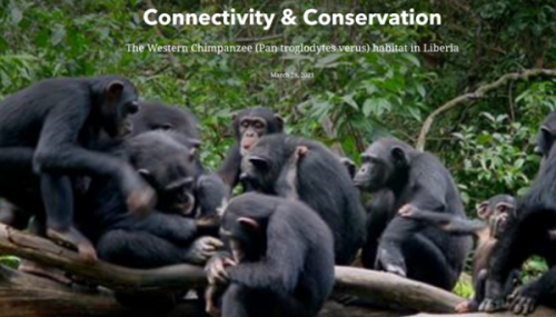
Connectivity and Conservation
Working in collaboration with Conservation International, Dr. Amy Frazier led research to better understand the makeup of western chimpanzee habitats at large spatial scales, including how potential habitats connect with one another for breeding and where they fall in relation to existing protected areas.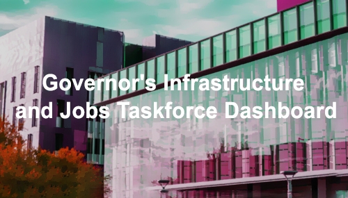
Governor's Infrastructure and Jobs Taskforce Dashboard
The Governor's Infrastructure and Jobs Taskforce dashboard, created with support from the Arizona State Land Department and GRS, provides insight into the Bipartisan Infrastructure Law's impact on Arizona communities. It offers data on BIL/IIJA projects, allowing users to filter and access real-time information.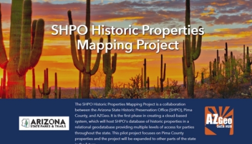
SHPO Mapping Project
The SHPO Historic Properties Mapping Project, in collaboration with Pima County and AZGeo, aims to create a cloud-based system for Arizona's historic property database. It offers accessibility through a hub site, a map viewer, partner data editing, and a data repository, benefiting stakeholders statewide.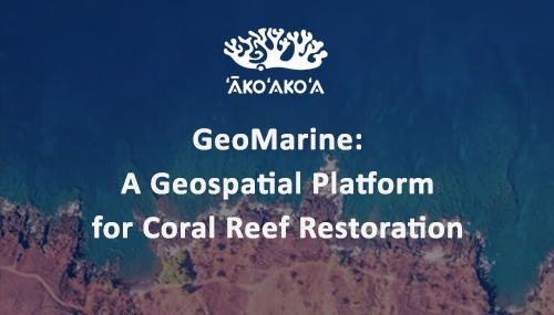
ʻĀkoʻakoʻa Geospatial Platform
The ʻĀkoʻakoʻa Reef Restoration platform provides a shared platform to foster a deeper connection between coastal and coral communities, promoting collective action in the face of climate change.
AZGeo Data Hub
The AZGeo Data Hub project was built in partnership with the Arizona State Land Department as a statewide open geospatial data repository: an authoritative data source for GIS professionals, various agencies, and the general public.
Cartography for The Anthropocene
The Anthropocene is an authoritative desk-top reference work for students of geography, the environment, and sustainability. It provides a comprehensive survey of humankind's impact on the global environment from the Late Stone Age to the present day.
Digital Twin
Utilizing ArcGIS CityEngine, the GRS team created a detailed 3-D model of a portion of ASU’s campus as a proof-of-concept for a digital twin for project related to broadband internet access.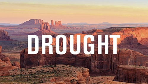
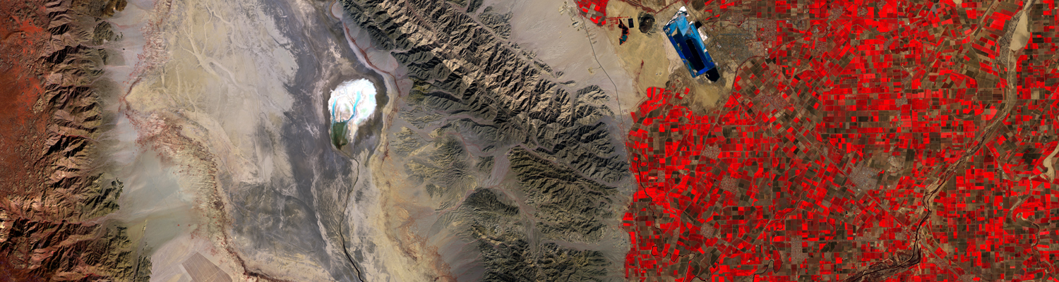
Drought Map Automation
The GRS team used Python to automate the creation of long-term drought maps for Arizona using advanced calculations from the State Climate Office. These maps inform decision-making and recommendations to address the ongoing drought in the region.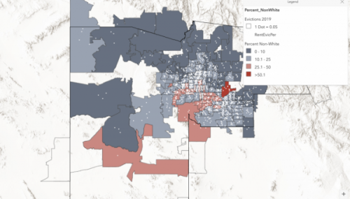
Eviction Mapping
GRS teams up with ASU’s Knowledge Exchange for Resilience to develop the Maricopa County Evictions Dashboard. It tracks and maps eviction data by zip code, models post-pandemic eviction surge potential.
Flood Index Project
The pilot study was Harris County, and GRS was asked to create weighted flood indices for every building within Harris County, which is home to Houston.
SafeBars Project
To support the Safer Bars Research Study, GRS was asked to create a kernel density of liquor licenses with an overlap of crime incidents for Phoenix, Tempe, and Tucson.
SW-IFL Heat Vulnerability Dashboard
GRS was contracted to develop a dashboard application that brings together Statewide data about heat, heat factors, and socio-demographic characteristics.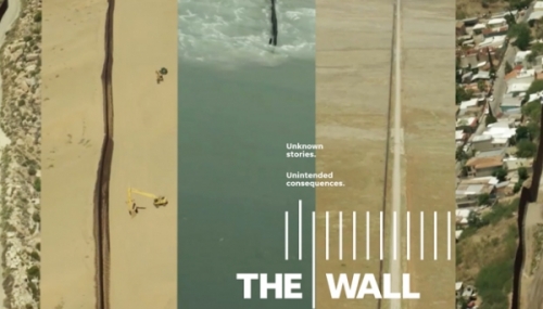
"The Wall" Border Mapping
Part of the “The Wall,” winner of the 2018 Pulitzer Prize for Explanatory Reporting, the work that GRS did with the Gannett/USA Today network included the creation of the most complete and updated map of the US-Mexico border, covering over 2000 miles.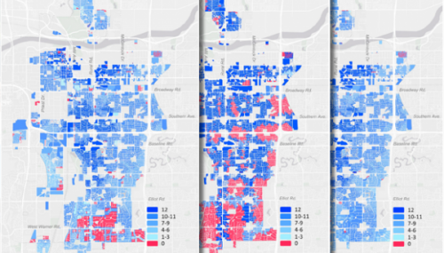
20-Minute City
The City of Tempe and GRS worked together to model multimodal transportation networks in Tempe, Arizona to research Tempe's status as a “20-minute city” with the results published in the journal Sustainability.
AZSite
AZSITE is a consolidated GIS network of recorded cultural resources, archaeological sites and surveys throughout Arizona. It was developed by GRS and is a collaborative project between the Arizona State Museum at the UofA, ASU's Archaeological Research Institute, the State Historic Preservation Office, and the Museum of Northern Arizona.
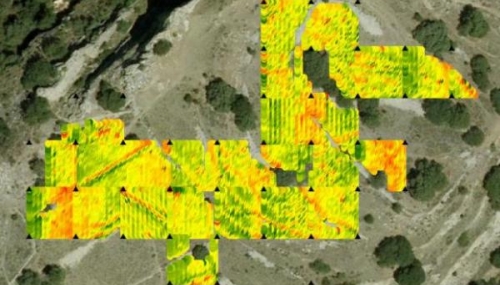
Mapping Invasive Vegetation
The Cactus Fire in 2017 prompted the Lower Salt River Restoration Project, aiming to restore native species while managing invasives. ASU's MAS-GIS students and Dr. Amy Frazier improved invasive species classification accuracy using drones, benefiting ecosystem restoration along Arizona's Lower Salt River region.
Mapping Populations
Under the direction of First Things First (FTF), the ASU's Morrison Institute conducted a regional analysis of key indicators in domains that contribute to a greater overall risk for poor child outcomes including: low socio-economic status, adverse perinatal outcomes, substance use, additional community stressors, and education challenges.
Geocoding: Mapping Addresses
Geocoding turns address data into points on a map, and can include overlay those points with some sort of area (census tract, congressional district), or creation of a map or a table showing the results.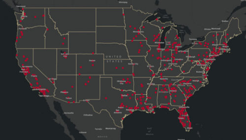
Mapping Cycling Deaths
The 2020 Cycling Deaths project was launched in partnership with the Outside Magazine and Bike Maps. GRS mapped every person on a bike killed by a driver in the U.S. over the course of the year.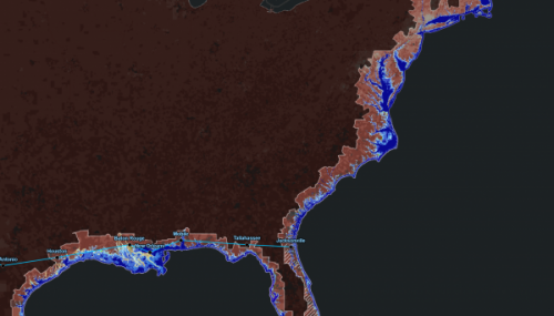
Mapping 10X
GRS designed an exploratory mapping tool for 10X to enhance sustainability and decision-making. It focuses on high-growth cities, particularly addressing sea level rise and social vulnerability for broader global application.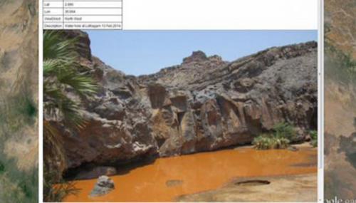
Turkana Data Project
GRS is working to develop a Google Earth-based data and mapping application for the Turkana Basin project, including location and distribution of fossils, photos, paleomagnetic lines, cross sections, and more.
Turning the Corner
Working with non-profits and neighborhood groups to collect, analyze, and map data related to the Turning the Corner neighborhood displacement project.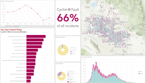
Bike Crashes Dashboard
A dashboard which helps decision makers better understand the data associated with bike crashes in Maricopa County between 2009 and 2016.
Census Data for Research
GRS is often asked to obtain census data for researchers and to perform various analyses, such as mapping demographics and processing raw tabular data into visualizations.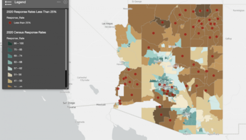
Census Response Mapping
Mapping response rates for the 2020 census in an interactive map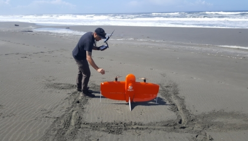
Data Collection and Creation
Field collection of data, processing, and creation of new data for research and client needs.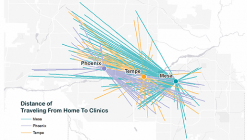
Distance Analysis
Distance analysis projects can help visualize data for travel patterns, facility usage, and accessibility.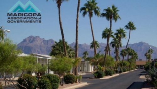
MAG Seasonal Housing Data Update
A major update to the GIS dataset pertaining to seasonal housing for the Maricopa Association of Governments (MAG).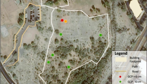
Mapping Desert Foothills Park
A iPad-based vector field-data collection as well as a UAS-based SfM-MVS photogrammetry survey of Desert Foothills Park.
¡Viva Maryvale!
The Viva Maryvale project was created as a partnership between multiple organizations to produce a health promotion and diabetes prevention program for families living in and around Maryvale, Arizona
Arizona Imagery Server
This project has produced an interactive mapping site showing statewide aerial imagery through the National Agricultural Imagery Program (NAIP).
SHPO Database Integration
Integration and synchronization of enterprise database systems for the State Historic Preservation Office (SHPO).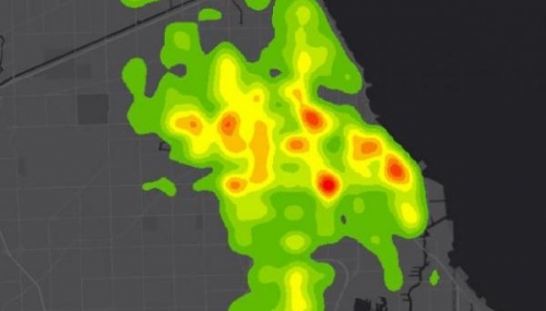
Crime Analysis
Development of methods and tools to help analysts map activity spaces and crime densities in Tempe, Arizona.